220,000+ results for antique maps
- New Listing1908 MAP OF PACIFIC COUNTY WASHINGTON SCHOOL DISTRICT 117Opens in a new window or tab$0.991 bid · Time left6d 13h left (Mon, 10:13 AM)+$12.00 shippingdigsbydix (6) 100%
- 1876 New York City, New York Vintage Old Panoramic NY City Map - 18x24Opens in a new window or tabBrand New$13.95+$5.95 shippingFree returns133 soldBuy 2, get 1 freeTop Rated Plusartscape_galleries (33,085) 99.5%
- 1920s “Map of the Island of Nantucket” Vintage Style Tony Sarg Map - 16x20Opens in a new window or tabBrand New$13.95+$5.95 shippingFree returns48 soldBuy 2, get 1 freeTop Rated Plusartscape_galleries (33,085) 99.5%
- The Iron Gate. Orsova Danube. Romania Serbia. Sketch map 1885 old antiqueOpens in a new window or tabPre-Owned$13.96+$10.16 shippingfrom United KingdomLast one4 watchersrichben1066 (24,102) 99.8%
- 1892 Indian Territory Historic Vintage Style Oklahoma Wall Map - 18x24Opens in a new window or tabBrand New$13.95+$5.95 shippingFree returns228 soldBuy 2, get 1 freeTop Rated Plusartscape_galleries (33,085) 99.5%
- 1830s Mammoth Cave Kentucky Vintage Cave System Map - 16x20Opens in a new window or tabBrand New$13.95+$5.95 shippingFree returnsAlmost gone19 soldBuy 2, get 1 freeTop Rated Plusartscape_galleries (33,085) 99.5%
- Territory of Alaska 1936 Vintage Style Steamship Route Map - 20x30Opens in a new window or tabBrand New$18.95+$5.95 shippingFree returnsAlmost gone38 soldBuy 2, get 1 freeTop Rated Plusartscape_galleries (33,085) 99.5%
- 1747 Map of the Gulf Coast - Louisiana to Florida - 20x24Opens in a new window or tabBrand New$16.95+$5.95 shippingFree returns27 soldBuy 2, get 1 freeTop Rated Plusartscape_galleries (33,085) 99.5%
- NYC Bronx New York 1897 Historic Panoramic Town Map - 8x24Opens in a new window or tabBrand New$13.95+$5.95 shippingFree returns12 watchersBuy 2, get 1 freeTop Rated Plusartscape_galleries (33,085) 99.5%
- 1757 North America and Louisiana Territory New World Map - 24x30Opens in a new window or tabBrand New$23.95+$5.95 shippingFree returns41 soldBuy 2, get 1 freeTop Rated Plusartscape_galleries (33,085) 99.5%
- 1882 Golden Colorado Vintage Old Panoramic City Map - 14x24Opens in a new window or tabBrand New$13.95+$5.95 shippingFree returns6 watchersBuy 2, get 1 freeTop Rated Plusartscape_galleries (33,085) 99.5%
- 1650s “Insulae Americanae” Vintage Style US Caribbean Map - 18x24Opens in a new window or tabBrand New$13.95+$5.95 shippingFree returns31 soldBuy 2, get 1 freeTop Rated Plusartscape_galleries (33,085) 99.5%
- 1863 Ohio Township and County Historic Vintage Style Wall Map - 24x28Opens in a new window or tabBrand New$23.95+$5.95 shippingFree returns27 soldBuy 2, get 1 freeTop Rated Plusartscape_galleries (33,085) 99.5%
- New Listing1846 UNITED STATES REPUBLIC OF TEXAS Map ORIGINAL Russian Alaska Canada IndiesOpens in a new window or tab$38.00Free shippingFree returnsselsa84 (5,115) 100%
- North America 1771 Colonial Map - 13 Colonies - 20x24Opens in a new window or tabBrand New$16.95+$5.95 shippingFree returns313 soldBuy 2, get 1 freeTop Rated Plusartscape_galleries (33,085) 99.5%
- 1845 KENTUCKY Map ORIGINAL Tanner's Geographical Establishment Louisville EXRAREOpens in a new window or tab$220.00Free shippingFree returnsselsa84 (5,115) 100%
- Savannah Georgia 1734 Historic Panoramic Town Map - 24x32Opens in a new window or tabBrand New$24.95+$5.95 shippingFree returns15 watchersBuy 2, get 1 freeTop Rated Plusartscape_galleries (33,085) 99.5%
- 1777 Map of Connecticut, New York, New Jersey & Long Island - 24x30Opens in a new window or tabBrand New$23.95+$5.95 shippingFree returns33 soldBuy 2, get 1 freeTop Rated Plusartscape_galleries (33,085) 99.5%
- 1862 Colton's Railroad and Military Map of the US 18x24Opens in a new window or tabBrand New$13.95+$5.95 shippingFree returns68 soldBuy 2, get 1 freeTop Rated Plusartscape_galleries (33,085) 99.5%
- New ListingOriginal Map Provincetown Massachusetts Wellfleet 1893/1923Opens in a new window or tab$17.990 bids · Time left6d 22h left (Mon, 07:11 PM)+$10.05 shippingvaluablethings (6,225) 100%
- 1890 Rhinebeck New York Vintage Old Panoramic NY City Map - 16x24Opens in a new window or tabBrand New$13.95+$5.95 shippingFree returnsBuy 2, get 1 freeTop Rated Plusartscape_galleries (33,085) 99.5%
- New York City, New York 1856 Historic Panoramic Town Map - 16x20Opens in a new window or tabBrand New$13.95+$5.95 shippingFree returns21 watchersBuy 2, get 1 freeTop Rated Plusartscape_galleries (33,085) 99.5%
- New ListingOriginal Map Saint Augustine Florida Fort Marion 1860Opens in a new window or tab$16.990 bids · Time left6d 22h left (Mon, 07:11 PM)+$5.50 shippingvaluablethings (6,225) 100%
- New Listing1886 MAP SHOWING THE DISTRIBUTION OF BLACK ROT OF THE GRAPE IN THE UNITED STATESOpens in a new window or tab$9.99+$5.75 shippingpm2828 (5,726) 100%
- New Listing1863 map of Texas at annexation Spanish Mexican territory Houston Austin SabineOpens in a new window or tab$49.99+$5.99 shippingFree returnsTop Rated Plusclarkhistory44 (1,100) 100%
- New Listing1886 MAP SHOWING THE DISTRIBUTION OF THE ENGLISH SPARROW IN THE UNITED STATES!Opens in a new window or tab$9.99+$5.75 shippingpm2828 (5,726) 100%
- New ListingAntique Original 1855 Colton Atlas MAP MARYLAND DELAWARE 17x13" Hand COloredOpens in a new window or tab$47.95+$5.75 shippingjjmhtm (18,222) 99.7%
- New ListingAntique Indian Territory Oklahoma Map 13 x 10.5 VTG Original Cherokee nationOpens in a new window or tab$16.87+$6.15 shippingFree returnsTop Rated Pluscotys-treasures (10,436) 99.3%
- 1851 UNITED STATES ORIGINAL TALLIS RAPKIN MAP 11x14 WM38Opens in a new window or tab$299.95+$7.45 shippingpapertique (3,549) 99.4%
- $20 Antique Maps: Tennessee 1800-1900s (2). See Pictures.Opens in a new window or tab$20.00+$5.85 shippingmoreth0 (18) 92.9%
- Antique 1924 Rand McNally Auto Trails Map district 7 md ny nj pa va wv 100 yrsOpens in a new window or tab$85.00Free shippingdevicetech (1,108) 100%
- United States Geological & Infrastructure Western Territories 1872 large mapOpens in a new window or tab$195.00+$6.95 shippingoldmapsoldbooks (12,058) 100%
- New ListingMap: 1910 United States Territorial Growth, Encycl. color, 8.25" x 10.75 "Opens in a new window or tab$4.000 bids · Time left9d 12h left (05/30, 09:00 AM)$7.00Buy It Now+$3.50 shippinggetagripnow (1,723) 100%
- New ListingOriginal Nautical Chart Hyannis Harbor Massachusetts Coast Survey 1933Opens in a new window or tab$19.990 bids · Time left6d 22h left (Mon, 07:14 PM)+$10.70 shippingvaluablethings (6,225) 100%
- 2009 Lake Winnipesaukee Navigation Chart Map Wolfeboro Alton Gilford NH BizerOpens in a new window or tab$7.19Was: $7.9910% off+$4.13 shippingFree returnsLast oneTop Rated Plusthebargainpug (5,502) 100%
- New Listing1886 MAP SHOWING THE DISTRIBUTION OF PERONOSPORA VITICOLA IN THE UNITED STATES!Opens in a new window or tab$9.99+$5.75 shippingpm2828 (5,726) 100%
- New Listing1913 MAP OF PORTION OF BATTLEFIELDS OF BULL RUN 14 x 23.25!Opens in a new window or tab$19.99Free shippingpm2828 (5,726) 100%
- New ListingAntique Original 1868 POMEROYS-BEERS ATLAS DELAWARE MAP Framed MILL CREEKOpens in a new window or tab$47.95+$10.80 shippingjjmhtm (18,222) 99.7%
- 1851 UNITED STATES OF AMERICA ORIGINAL TALLIS MAP 11x14 WM84Opens in a new window or tab$299.95+$7.45 shippingpapertique (3,549) 99.4%
- 1850 ATLAS MAP OF THE U.S. TALLIS RAPKINOpens in a new window or tab$425.00+$20.63 shippingbellevueplace2 (238) 100%
- New ListingOriginal Topographical Map Brooklyn New York Quadrangle BeachesOpens in a new window or tab$16.990 bids · Time left6d 22h left (Mon, 07:10 PM)+$10.05 shippingvaluablethings (6,225) 100%
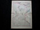
- New ListingN.E. Minnesota Large State 1889 M Bradley & Bros Detailed Hand Colored Old MapOpens in a new window or tab$39.00+$5.00 shippingcaraninfo (1,928) 100%
- New ListingMap: 1910 North Polar Regions, aerial, glaciers, Encycl. B&W, 8.25" x 11"Opens in a new window or tab$4.000 bids · Time left9d 12h left (05/30, 09:00 AM)$7.00Buy It Now+$3.50 shippinggetagripnow (1,723) 100%
- New Listing1872 Antique Map Southern U.S. States Map Approx 8”x10.25” Drawing InstructionsOpens in a new window or tab$14.40Was: $15.165% off+$5.80 shippingFree returnsTop Rated Plusloggsliquidations (2,273) 100%
- New Listing1889 Railroad Map ~ MINNESOTA ~ Authentic McNally Atlas Map (14x20) #012Opens in a new window or tab$24.000 bids · Time left4d 17h left (Sat, 02:04 PM)Free shippingFree returnsmaphatter (7,624) 99.5%
- New ListingVintage USGS Myrtle Beach South Carolina Topo Map 1936 - 1937 Survey 17" x 21"Opens in a new window or tab$14.00+$3.96 shippingbrengber (3,718) 100%
- New Listing1876 Map BALTIMORE, MD Original National Atlas Map by O.W. Gray ~ (14x17) -#021Opens in a new window or tab$34.000 bids · Time left4d 18h left (Sat, 03:41 PM)Free shippingFree returnsmaphatter (7,624) 99.5%
- New Listing1872 BEERS ATLAS OF ESSEX COUNTY, MASSACHUSETTS-MAP OF ESSEX & RIVERDALEOpens in a new window or tab$30.00+$7.00 shippingsajek (12,292) 100%
- New ListingPocket Map Connecticut Colored Bridgeport Hotel 1895Opens in a new window or tab$15.990 bids · Time left6d 22h left (Mon, 07:13 PM)+$5.50 shippingvaluablethings (6,225) 100%
- New Listing1886 MAP SHOWING THE DISTRIBUTION OF PEAR BLIGHT IN THE UNITED STATES!Opens in a new window or tab$9.99+$5.75 shippingpm2828 (5,726) 100%
- New ListingCombined Atlas 1910 1929 Tazewell County Illinois IL Plat BookOpens in a new window or tab$84.95+$10.32 shippinglivinintheboonies (28,864) 99.7%
- New Listing1858 ORIGINAL MAP UNITED STATES TEXAS VIRGINIA NEW YORK ARKANSAS ILLINOIS IOWAOpens in a new window or tab$64.990 bids · Time left9d 18h left (05/30, 03:08 PM)+$16.00 shippingfrom Polandartlusatica (1,295) 98.5%
- New Listing1877 Map ~ MINNESOTA ~ Authentic National Atlas Map by O.W. Gray ~ (17x28) #033Opens in a new window or tab$34.000 bids · Time left4d 16h left (Sat, 01:17 PM)Free shippingFree returnsmaphatter (7,624) 99.5%
- Topographic Map of Craters of the Moon, National Monument 1957 - US Geo. SurveyOpens in a new window or tab$10.00+$4.13 shippingSave up to 20% when you buy morehmhlyons2012 (2,496) 100%
- New Listing1877 Map ~ KENTUCKY - TENNESSEE ~ National Atlas Map by O.W. Gray ~ (17x28) #032Opens in a new window or tab$34.000 bids · Time left4d 18h left (Sat, 03:35 PM)Free shippingFree returnsmaphatter (7,624) 99.5%
- New Listing1884 map United States Revolution to 1884 Moss Eng Co New York territory GR BritOpens in a new window or tab$49.99+$5.99 shippingFree returnsTop Rated Plusclarkhistory44 (1,100) 100%
- New Listing1855 Map ~ IOWA ~ Authentic Colton Atlas Map (15x17) -#010Opens in a new window or tab$34.000 bids · Time left4d 19h left (Sat, 03:53 PM)Free shippingFree returnsmaphatter (7,624) 99.5%
- New Listing1780 ORIGINAL MAP UNITED STATES GEORGIA COUTH CAROLINA NORTH CAROLINA VIRGINIAOpens in a new window or tab$114.990 bids · Time left9d 18h left (05/30, 03:00 PM)+$16.00 shippingfrom Polandartlusatica (1,295) 98.5%
- USGS Geologic Map: Northport Quadrangle, WashingtonOpens in a new window or tab$12.25Was: $12.895% off+$5.86 shippingFree returnsbluesagecollectibles21 (1,914) 100%
- New Listing1831 RARE ORIGINAL MAP UNITED STATES TEXAS FLORIDA CANADA ASIA AUSTRALIA WORLDOpens in a new window or tab$77.990 bids · Time left9d 18h left (05/30, 03:02 PM)+$16.00 shippingfrom Polandartlusatica (1,295) 98.5%
- New ListingAntique WYOMING Map Wall Art Decor Original Vintage Yellowstone Park DATED 1907Opens in a new window or tab$13.95+$4.95 shippingFree returnsTop Rated Plussnapshotsthroughtime (312) 100%
- New Listing1855 Map ~ NEW YORK STATE ~ Authentic Colton Atlas Map (15x17) -#009Opens in a new window or tab$34.000 bids · Time left4d 16h left (Sat, 01:27 PM)Free shippingFree returnsmaphatter (7,624) 99.5%
- New Listing1876 Map MAINE ~ National Atlas Map by O.W. Gray & J.H. Colton~ (14x17) -#023Opens in a new window or tab$34.000 bids · Time left4d 19h left (Sat, 03:49 PM)Free shippingFree returnsmaphatter (7,624) 99.5%
- New ListingMap: 1910 Alaska (AK) - topography, railways, islands - Encycl. B&W, 8" x 11.5"Opens in a new window or tab$4.000 bids · Time left9d 12h left (05/30, 09:00 AM)$7.00Buy It Now+$3.50 shippinggetagripnow (1,723) 100%
- New Listing1876 Map ~ NEW YORK ~ Authentic National Atlas Map by O.W. Gray ~ (17x28) #028Opens in a new window or tab$34.000 bids · Time left4d 16h left (Sat, 01:09 PM)Free shippingFree returnsmaphatter (7,624) 99.5%
- New ListingAntique OREGON Map Wall Art Decor Original Vintage Portland Salem DATED 1907Opens in a new window or tab$13.95+$4.95 shippingFree returnsTop Rated Plussnapshotsthroughtime (312) 100%
- New Listing1876 Map MISSOURI ~ Original National Atlas Map by O.W. Gray ~ (14x17) -#022Opens in a new window or tab$34.000 bids · Time left4d 16h left (Sat, 01:07 PM)Free shippingFree returnsmaphatter (7,624) 99.5%
- New Listing1876 WISCONSIN Map ~ Original National Atlas Map by O.W. Gray ~ (14x17) #019Opens in a new window or tab$34.000 bids · Time left4d 16h left (Sat, 01:35 PM)Free shippingFree returnsmaphatter (7,624) 99.5%
- Vintage 24”x 18” Map Poster First Permanent Settlements On The DelawareOpens in a new window or tab$9.00+$5.90 shippingFree returnsshildinc (4,012) 99.3%
- 1860 North America Hand Coloured Antique Map by G.W. BlackieOpens in a new window or tab$50.78+$13.97 shippingfrom United KingdomFree returnsdiddersgoods (2,931) 100%
- 1887 Original Antique Mitchell Maps: Minnesota & Dakota TY and Nebraska (Scarce)Opens in a new window or tab$85.00+$5.95 shippingstudioc (1,537) 100%
- Items Per Page