Picture 1 of 2

Stock photo


Picture 1 of 2
Stock photo


South Africa : Adventure Travel Map by National Geographic Staff and National Geographic Maps - Adventure (2025, Sheet Map, Folded)
B
bonzon (1900)
100% positive feedback
Price:
$5.94
+ $4.47 shipping
Returns:
14 days returns. Buyer pays for return shipping. If you use an eBay shipping label, it will be deducted from your refund amount.
Condition:
New As pictured
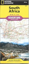
- Buy It NowSouth Africa National Geographic Adventure Maps #3204
Oops! Looks like we're having trouble connecting to our server.
Refresh your browser window to try again.
About this product
Product Identifiers
PublisherNational Geographic Maps
ISBN-101566955319
ISBN-139781566955317
eBay Product ID (ePID)113378562
Product Key Features
Edition2025
Book TitleSouth Africa : Adventure Travel Map
Number of Pages1 Pages
LanguageEnglish
TopicMaps & Road Atlases (See Also Reference / Atlases, Gazetteers & Maps), Africa / Republic of South Africa
Publication Year2025
FeaturesRevised
IllustratorYes
GenreTravel
AuthorNational Geographic Staff, National Geographic Maps-Adventure
Book SeriesNational Geographic Adventure Map Ser.
FormatSheet Map, Folded
Dimensions
Item Height0.1 in
Item Weight3.3 Oz
Item Length9.2 in
Item Width4.2 in
Additional Product Features
Intended AudienceTrade
Series Volume Number3204
Edition DescriptionRevised edition
Synopsis- Waterproof - Tear-Resistant - Travel Map National Geographic's South Africa Adventure Map provides global travelers with the perfect combination of detail and perspective in a highly functional travel tool. Hundreds of points of interest that highlight the diverse, unique, and exotic destinations within the country such as national parks and reserves, sanctuaries, World Heritage sites, archeological sites, and museums are noted. Along the coast between Cape Town (the legislative capital) and Port Elizabeth, areas for whale watching and shark-cage diving are noted. Dozens of beaches are noted from the Sunshine Coast to the North Coast for travelers wishing to soak up some sun. The map includes the locations of cities and towns with a user-friendly index, plus a clearly marked road network complete with distances and designations for major highways, main roads, and tracks and trails for those seeking to explore more remote regions. Important travel aids like airports, airfields, rail lines, ferry routes, and lighthouses are included as well. The west side of the South Africa map includes the Northern Cape, Western Cape, Eastern Cape, and portions of the North West and Free State provinces. Johannesburg and neighboring city Pretoria (administrative capital) are included on the east side of the map along with Bloemfontein (judicial capital) and the coastal city of Durban. Every Adventure Map is printed on durable synthetic paper, making them waterproof, tear-resistant and tough -- capable of withstanding the rigors of international travel. Map Scale = 1:1,550,000 Sheet Size = 25.5" x 37.75" Folded Size = 4.25" x 9.25", National Geographic's South Africa AdventureMap is designed to meet the unique needs of adventure travelers detailed, durable, and accurate. South Africa includes the locations of thousands of major cities and towns with an index for easily locating them, plus a clearly marked road network complete with distances and designations for major highways, limited access highways, and more. Both paved and unpaved roads, tracks, and trails are marked for those adventurers who wish to explore less traveled routes. What sets National Geographic AdventureMaps apart from traditional road maps are the hundreds of points-of-interest that highlight the diverse, unique, and exotic destinations within South Africa including national parks and reserves, sanctuaries, World Heritage sites, archeological sites, museums, and important travel aids like airports, airfields, rail lines, ferry routes, and lighthouses. The west side of the South Africa map includes the Northern Cape, Western Cape, Eastern Cape, and portions of the North West and Free State provinces. Diverse points of interest are featured including the Western Cape's wine regions and spas. Along the coast between Cape Town, the legislative capital, and Port Elizabeth, areas for whale watching and shark-cage diving are noted. Johannesburg and neighboring city Pretoria (administrative capital) are included on the east side of the map along with Bloemfontein (judicial capital) and the coastal city of Durban. South Africa's many national parks, reserves, and wildlife sanctuaries are clearly marked, as are other natural points of interest and scenic viewpoints. Dozens of beaches are noted from the Sunshine Coast to the North Coast for travelers wishing to soak up some sun. Our South Africa AdventureMap is printed in the U.S.A. on a durable synthetic paper, making it waterproof, tear-resistant, and trail tough capable of going anywhere you do. The map is two-sided, and can be folded to a packable size of (4.25" x 9.25"), unfolded size is (26" x 38")., National Geographic's South Africa Adventure Map is designed to meet the unique needs of adventure travelers with its durability and accurate information. This folded map provides global travelers with the perfect combination of detail and perspective, highlighting hundreds of points of interest and the diverse and unique destinations within the country. The map includes the locations of cities and towns with a user-friendly index, plus a clearly marked road network complete with distances and designations for major highways, main roads, and tracks and trails for those seeking to explore more remote regions. The west side of the South Africa map includes the Northern Cape, Western Cape, Eastern Cape, and portions of the North West and Free State provinces. Johannesburg and neighboring city Pretoria (administrative capital) are included on the east side of the map along with Bloemfontein (judicial capital) and the coastal city of Durban. Every Adventure Map is printed on durable synthetic paper, making them waterproof, tear-resistant and tough - capable of withstanding the rigors of international travel. Each is two-sided and can be folded to a packable size of 235 x 108 mm; unfolded size is 965 x 660 mm.
All listings for this product


![South Africa: Travel Maps International Adventure Map [Sheet map, folded]](https://i.ebayimg.com/images/g/lacAAeSwM1VojUlK/s-l225.jpg)


Ratings and Reviews
Most relevant reviews
- Nov 15, 2016
great deal
wonderful mapVerified purchase: YesCondition: New