Picture 1 of 3


Gallery
Picture 1 of 3


Have one to sell?
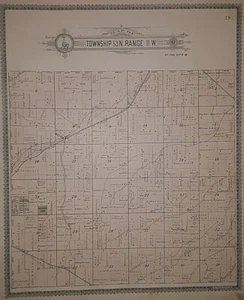
1899 Plat Map ~ .WATSON Twp., PIKE Co., MISSOURI ~ CHICAGO & ALTON RAILROAD

US $48.88
or Best Offer
or 4 interest-free payments of $12.22 available with
Condition:
“Always Quick N Free S&H ~ Reasonable offers always considered. Browse through over 4000 Rare, ”... Read moreabout condition
- Buy It Now1899 Plat Map ~ .WATSON Twp., PIKE Co., MISSOURI ~ CHICAGO & ALTON RAILROAD
Oops! Looks like we're having trouble connecting to our server.
Refresh your browser window to try again.
Shipping:
Free FedEx Ground Economy®.
Located in: Schertz, Texas, United States
Delivery:
Estimated between Tue, Oct 14 and Mon, Oct 20 to 94104
Returns:
30 days returns. Buyer pays for return shipping. If you use an eBay shipping label, it will be deducted from your refund amount.
Payments:
.
Special financing available. See terms and apply now- for PayPal Credit, opens in a new window or tab
Earn up to 5x points when you use your eBay Mastercard®. Learn moreabout earning points with eBay Mastercard
Shop with confidence
Seller assumes all responsibility for this listing.
eBay item number:405353967394
Item specifics
- Seller Notes
- Cartographer/Publisher
- Geo. A. Ogle & Co.
- Original/Reproduction
- Antique Original
- California Prop 65 Warning
- None
- Format
- Plat Atlas Map
- Color
- All colors are original.
- Frame
- Suitable for framing.
- Ref#
- PIKE-MO1899/072722
- Type
- County / Township Map
- Original
- This map page was printed in 1899.
- Year
- 1899
- US State
- United States, AR, IA, KS, LA, MO, NE, Missouri
- City
- Pike County
- Date Range
- 1800-1899
- Country/Region
- United States of America
Item description from the seller

Seller feedback (10,000)
- w***3 (402)- Feedback left by buyer.Past 6 monthsVerified purchaseWhat should have been a speedy delivery via Ground Advantage delayed due to the incompetence of the USPS. Item sent from Texas to Chicago, then to Pennsylvania (!), the back to Chicago, finally delivered on July 22. The seller did everything right: prompt shipping, excellent packaging, item as described and worth the price. The score: Seller 10, USPS 0.
- o***d (917)- Feedback left by buyer.Past 6 monthsVerified purchaseItem exactly as described and shipped in a very protective package. It took almost 3 weeks for the shipping but the shipping was included in the price. Very good value and worth waiting for. Thank you!1898 City Map ~ PITTSBURGH & ALLEGHENY, PENNSYLVANIA (14x22)-#149 (#357219486507)
- i***a (533)- Feedback left by buyer.Past monthVerified purchaseExactly as advertised and pleased with how fast seller shipped item and that it encased in a tube for mailing. Pricing was extremely reasonable for such a collectible item. I would certainly buy from this seller again.
More to explore :
- Missouri 1800-1899 Date Range Antique North America Railroad Maps,
- Missouri Antique North America Railroad Maps,
- Rand McNally & Co. 1800-1899 Date Range Antique Railroad Maps,
- Chicago Antique North America Railroad Maps,
- St. Louis Missouri Antique North America Railroad Maps,
- Bureau Plat In Antique Desks & Secretaries (1800-1899),
- Missouri 1800-1899 Date Range Antique North America County Maps,
- Rand McNally & Co. Lithography Antique Railroad Maps,
- Lithography 1800-1899 Date Range Antique Railroad Maps,
- Missouri Antique North American Maps Atlas 1800-1899 Date Range & Atlases
Seller feedback (10,000)
- w***3 (402)- Feedback left by buyer.Past 6 monthsVerified purchaseWhat should have been a speedy delivery via Ground Advantage delayed due to the incompetence of the USPS. Item sent from Texas to Chicago, then to Pennsylvania (!), the back to Chicago, finally delivered on July 22. The seller did everything right: prompt shipping, excellent packaging, item as described and worth the price. The score: Seller 10, USPS 0.
- o***d (917)- Feedback left by buyer.Past 6 monthsVerified purchaseItem exactly as described and shipped in a very protective package. It took almost 3 weeks for the shipping but the shipping was included in the price. Very good value and worth waiting for. Thank you!1898 City Map ~ PITTSBURGH & ALLEGHENY, PENNSYLVANIA (14x22)-#149 (#357219486507)
- i***a (533)- Feedback left by buyer.Past monthVerified purchaseExactly as advertised and pleased with how fast seller shipped item and that it encased in a tube for mailing. Pricing was extremely reasonable for such a collectible item. I would certainly buy from this seller again.