Picture 1 of 1
Stock photo

Picture 1 of 1
Stock photo
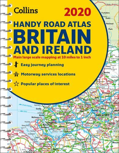
2020 Collins Handy Road Atlas Britain and Ireland by Collins Maps (2019, Spiral)

rarewaves-usa (495397)
98.6% positive feedback
Price:
$10.49
Free shipping
Returns:
30 days returns. Buyer pays for return shipping. If you use an eBay shipping label, it will be deducted from your refund amount.
Condition:
The atlas has been fully updated for 2020. Publisher: Collins. Format: Spiral Bound. • Park & Ride locations (for bus and rail). • Handy distance calculator chart highlighting distances between the major towns.
- Buy It Now2020 Collins Handy Road Atlas Britain and Ireland (Spiral Bound)
Oops! Looks like we're having trouble connecting to our server.
Refresh your browser window to try again.
About this product
Product Identifiers
PublisherHarperCollins The Limited
ISBN-100008318719
ISBN-139780008318710
eBay Product ID (ePID)19038194225
Product Key Features
Book Title2020 Collins Handy Road Atlas Britain and Ireland
Number of Pages80 Pages
LanguageEnglish
Publication Year2019
TopicMaps & Road Atlases (See Also Reference / Atlases, Gazetteers & Maps), Europe / Great Britain
FeaturesNew Edition
GenreTravel
AuthorCollins Maps
FormatSpiral
Dimensions
Item Height0.2 in
Item Weight4.3 Oz
Item Length8.3 in
Item Width6.1 in
Additional Product Features
Intended AudienceTrade
Edition DescriptionNew Edition
SynopsisThis easy-to-use, handy A5 sized road atlas with popular lie-flat spiral binding features extremely clear route planning maps of Britain and Ireland and fits neatly into your glove box, briefcase or bag. The atlas has been fully updated for 2020., This easy-to-use, handy A5 sized road atlas with popular lie-flat spiral binding features extremely clear route planning maps of Britain and Ireland and fits neatly into your glove compartment, briefcase or bag. The atlas has been fully updated for 2020. The maps of Britain are at 9.9 miles to 1 inch (1:625,000) and the whole of Ireland is covered at 15.8 miles to 1 inch (1:1,000,000). There are also a selection of more detailed urban area maps at 4.5 miles to 1 inch (1:285,000) to aid route planning in these busy areas. Includes road maps that focus on the main roads, motorways and settlements; more detailed maps of London, Manchester, Merseyside and West Midlands; Park & Ride locations (for bus and rail); and handy distance calculator chart highlighting distances between the major towns., This easy-to-use, handy A5 sized road atlas with popular lie-flat spiral binding features extremely clear route planning maps of Britain and Ireland and fits neatly into your glove box, briefcase or bag. The atlas has been fully updated for 2020. The maps of Britain are at 9.9 miles to 1 inch (1:625,000) and the whole of Ireland is covered at 15.8 miles to 1 inch (1:1,000,000). There are also a selection of more detailed urban area maps at 4.5 miles to 1 inch (1:285,000) to aid route planning in these busy areas. Road maps that focus on the main roads, motorways and settlements More detailed maps of London, Manchester, Merseyside and West Midlands Park & Ride locations (for bus and rail) Handy distance calculator chart highlighting distances between the major towns
All listings for this product
![2020 Collins Handy Road Atlas Britain [New Edition] Spiral Collin](https://i.ebayimg.com/images/g/ZmAAAeSwKL9oOA7c/s-l225.jpg)


Ratings and Reviews
Most relevant reviews
- Sep 22, 2020
Seems like a new one.
For a used product, this atlas is in fantastic condition.Verified purchase: YesCondition: New


