
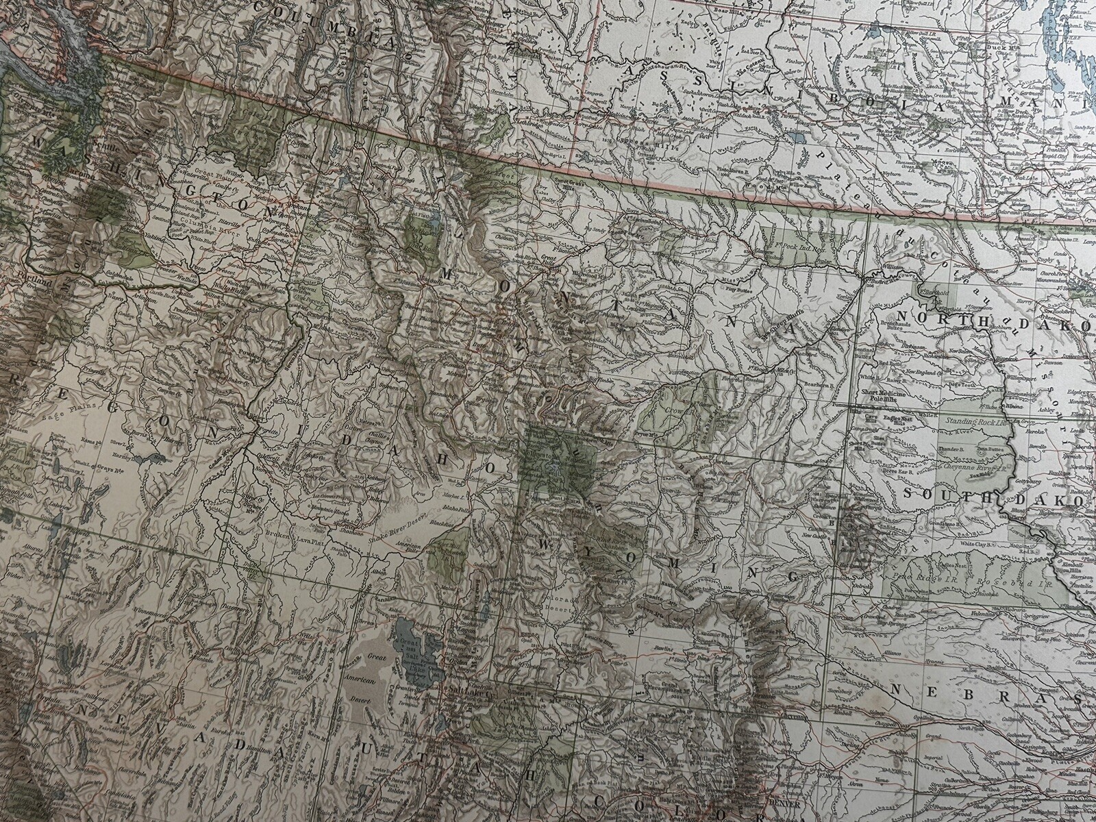
1898-1910 Northwest USA & Southwest Canada Original Antique Map
US $49.95US $49.95
Thu, Aug 28, 03:50 AMThu, Aug 28, 03:50 AM
Picture 1 of 3


Gallery
Picture 1 of 3


Have one to sell?
1898-1910 Northwest USA & Southwest Canada Original Antique Map
US $49.95
or Best Offer
Condition:
“This is an Original Antique Map from the year stated in title. All of our maps are stored in ”... Read moreabout condition
Oops! Looks like we're having trouble connecting to our server.
Refresh your browser window to try again.
Shipping:
US $8.95 USPS Ground Advantage®.
Located in: Galway, New York, United States
Save on combined shipping
Delivery:
Estimated between Tue, Oct 14 and Tue, Oct 21 to 94104
Returns:
30 days returns. Buyer pays for return shipping. If you use an eBay shipping label, it will be deducted from your refund amount.
Payments:
.
Special financing available. See terms and apply now- for PayPal Credit, opens in a new window or tab
Earn up to 5x points when you use your eBay Mastercard®. Learn moreabout earning points with eBay Mastercard
Shop with confidence
Seller assumes all responsibility for this listing.
eBay item number:365593367512
Item specifics
- Seller Notes
- Cartographer/Publisher
- Steiler's
- Country/Region
- United States of America
- Date Range
- 1900-1909
- Format
- Atlas Map
- Original/Reproduction
- Antique Original
- Printing Technique
- Lithography
- Type
- County Map
- US State
- Florida, Mississippi, New Jersey, New York, Tennessee, Iowa, Indiana, Georgia
- Year
- 1910
Item description from the seller
Seller Feedback
No feedback yet
More to explore :
- Northwest Territories Canada Antique Original Antique North America Maps & Atlases,
- Northwest Territories Canada Antique North America Maps & Atlases,
- Antique Original 1910-1919 Date Range Antique Topographical Maps,
- Antique Original 1910-1919 Date Range Antique Atlas Maps,
- Antique Original 1910-1919 Date Range Antique County Maps,
- Antique Original 1910-1919 Date Range Antique Nautical Maps,
- Antique Original 1910-1919 Date Range Antique Curiosities Maps & Atlases,
- Antique Original 1910-1919 Date Range Antique World Folding Maps,
- Quebec Canada Antique Original Antique North American Maps & Atlases,
- Canada 1910-1919 Date Range Antique North America Atlas Maps