
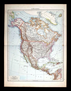
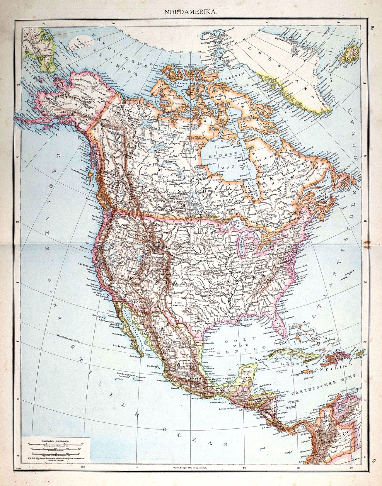
1881 Andrees Map North America United States Canada Mexico West Indies Alaska
US $23.99US $23.99
Sat, Jun 21, 07:28 PMSat, Jun 21, 07:28 PM
Picture 1 of 5


Gallery
Picture 1 of 5


Have one to sell?
1881 Andrees Map North America United States Canada Mexico West Indies Alaska
US $23.99
or Best Offer
Was US $29.99 (20% off)
Condition:
“Good, on a 16 1/2 by 22 inch (42x56cm) page, see the pic and description below for more on ”... Read moreabout condition
Ended: Jun 21, 2025 19:28:04 PDT
Oops! Looks like we're having trouble connecting to our server.
Refresh your browser window to try again.
Shipping:
US $4.99 USPS Ground Advantage®.
Located in: Fairview, Pennsylvania, United States
Delivery:
Estimated between Mon, Sep 22 and Sat, Sep 27 to 94104
Returns:
30 days returns. Seller pays for return shipping.
Payments:
Special financing available. See terms and apply now- for PayPal Credit, opens in a new window or tab
Earn up to 5x points when you use your eBay Mastercard®. Learn moreabout earning points with eBay Mastercard
Shop with confidence
Seller assumes all responsibility for this listing.
eBay item number:365147570804
Item specifics
- Seller Notes
- Cartographer/Publisher
- Andrees
- Original/Reproduction
- Antique Original
- Canadian Province
- Alberta, British Columbia, Manitoba, New Brunswick, Nova Scotia, Ontario, Prince Edward Island
- Format
- Atlas Map
- Topic
- United States
- Region
- North America & Canada
- Type
- Political Map
- Year
- 1881
- US State
- AK, HI, AL, FL, GA, MS, NC, SC, Alaska, AR, IA, KS, LA, MO, NE, Arkansas, AZ, CA, CO, NM, NV, UT, Colorado, Texas
- Date Range
- 1800-1899
- City
- Washington
- Country/Region
- Canada
Item description from the seller
Seller Feedback
No feedback yet
More to explore :
- United States of America Alaska Antique North America Geological Maps,
- United States of America Alaska Antique North America Maps & Atlases,
- Canada Alaska Antique North America Maps & Atlases,
- United States of America New Mexico Antique North America Topographical Maps,
- United States of America New Mexico Antique North America Maps & Atlases,
- United States of America Lithography West Virginia Antique North America Maps & Atlases,
- Alaska Antique North America Folding Maps,
- Alaska Antique North America County Maps,
- Alaska Antique North America City Maps,
- United States of America Antique North America Nautical Maps