
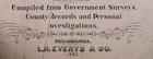
Original 1887 Plat Map ~ SEDAN - FARLINGTON, KANSAS ~ CHAUTAUQUA Co. on Reverse
US $27.15US $27.15
Wed, Jun 25, 11:03 AMWed, Jun 25, 11:03 AM
Picture 1 of 5


Gallery
Picture 1 of 5


Have one to sell?
Original 1887 Plat Map ~ SEDAN - FARLINGTON, KANSAS ~ CHAUTAUQUA Co. on Reverse
US $27.15
or Best Offer
Was US $28.88 (6% off)
Condition:
“Always Quick N Free S&H ~ Reasonable offers always considered. Browse through over 4000 Rare, ”... Read moreabout condition
Ended: Jun 25, 2025 11:03:13 PDT
Oops! Looks like we're having trouble connecting to our server.
Refresh your browser window to try again.
Shipping:
Free USPS Ground Advantage®.
Located in: Schertz, Texas, United States
Delivery:
Estimated between Tue, Sep 16 and Mon, Sep 22 to 94104
Returns:
30 days returns. Buyer pays for return shipping. If you use an eBay shipping label, it will be deducted from your refund amount.
Payments:
Special financing available. See terms and apply now- for PayPal Credit, opens in a new window or tab
Earn up to 5x points when you use your eBay Mastercard®. Learn moreabout earning points with eBay Mastercard
Shop with confidence
Seller assumes all responsibility for this listing.
eBay item number:356826932191
Item specifics
- Seller Notes
- Frame
- Suitable for framing.
- Printing Technique
- Hand Colored
- US State
- United States, AR, IA, KS, LA, MO, NE, Kansas
- Color
- All colors are original.
- Cartographer/Publisher
- L. H. Everts & Co.
- California Prop 65 Warning
- None
- Date Range
- 1800-1899
- Type
- County Map
- Format
- Plat Atlas Map
- Year
- 1887
- Ref#
- KANSAS1887/110822
- Original/Reproduction
- Antique Original
- Country/Region
- United States of America
- Original
- This map page was printed in 1887.
Item description from the seller
Seller Feedback
No feedback yet
More to explore :
- Rand McNally & Co. Kansas Antique North America Maps & Atlases,
- Kansas Vintage Original Antique North America Maps & Atlases,
- Kansas Vintage Original Antique North America Topographical Maps,
- Kansas Vintage Original Antique North America City Maps,
- Kansas Antique Original Antique North America County Maps,
- Rand McNally & Co. Antique Original Antique Railroad Maps,
- Antique North American Maps & Atlases Kansas,
- Kansas Topographical Map Antique North America Folding Maps,
- Rand McNally & Co. Antique Original Antique World Wall Maps,
- Rand McNally & Co. Antique Original Antique Europe Atlas Maps