
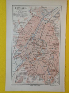
1897 BRUSSELLS Vintage Map Belgium City Plan Urban Streets ORIGINAL Color C18-6
US $21.90US $21.90
Thu, Oct 23, 12:36 PMThu, Oct 23, 12:36 PM
Picture 1 of 3


Gallery
Picture 1 of 3


Have one to sell?
1897 BRUSSELLS Vintage Map Belgium City Plan Urban Streets ORIGINAL Color C18-6
US $21.90
Condition:
“The map's condition is as shown in the pictures.”
Oops! Looks like we're having trouble connecting to our server.
Refresh your browser window to try again.
Pickup:
Free local pickup from Jasper, Florida, United States 32052
Shipping:
US $6.80 USPS Ground Advantage®.
Located in: Jasper, Florida, United States
Delivery:
Estimated between Fri, Nov 28 and Wed, Dec 3 to 94104
Returns:
30 days returns. Buyer pays for return shipping. If you use an eBay shipping label, it will be deducted from your refund amount.
Payments:
Special financing available. See terms and apply now- for PayPal Credit, opens in a new window or tab
Earn up to 5x points when you use your eBay Mastercard®. Learn moreabout earning points with eBay Mastercard
Shop with confidence
About this item
Seller assumes all responsibility for this listing.
eBay item number:356288707030
Item specifics
- Seller Notes
- “The map's condition is as shown in the pictures.”
- Date Range
- 1800-1899
- Type
- City Map
- Printing Technique
- Lithography
- Format
- Sheet Map
- Year
- 1897
- Original/Reproduction
- Vintage Original
- Cartographer/Publisher
- Meyers Konv. Lexicon
- City
- Brussels
- Country/Region
- Belgium
Item description from the seller
Seller Feedback
No feedback yet
More to explore :
- Brussels Belgium Antique Europe City Maps,
- Brussels Belgium Antique Original Antique European Maps & Atlases,
- Antique European Maps & Atlases Brussels Belgium,
- Brussels Belgium Lithography Antique Europe Maps & Atlases,
- Brussels Antique Europe City Maps,
- Belgium City Map Antique Europe Atlas Maps,
- Belgium Vintage Original Antique Europe Maps & Atlases,
- Brussels Belgium Antique European Maps & Atlases 1700-1799 Date Range,
- Belgium Antique Original Antique Europe Sheet Maps,
- Belgium 1600-1699 Date Range Antique Europe City Maps