Picture 1 of 14


Gallery
Picture 1 of 14


Have one to sell?
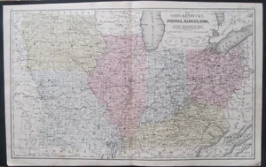
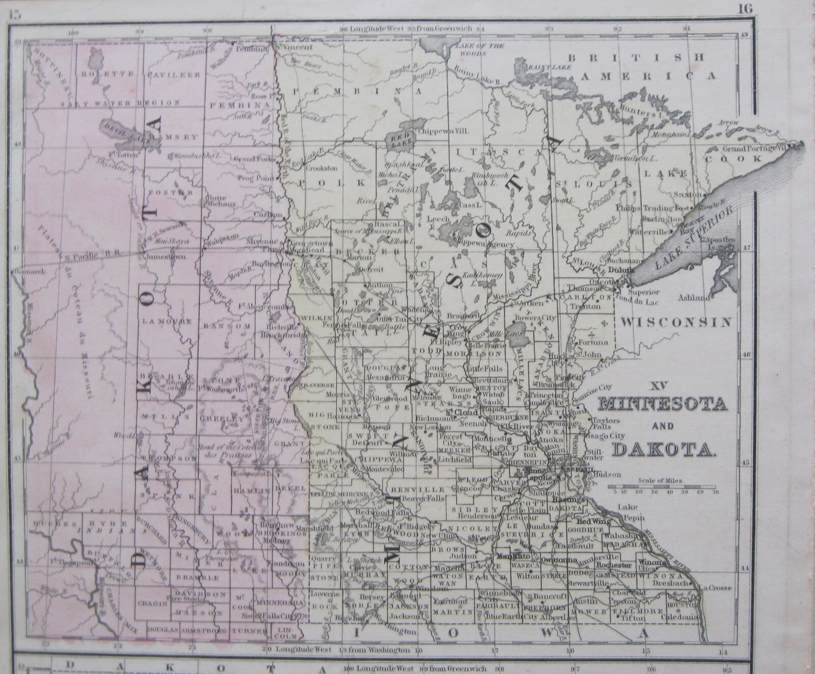
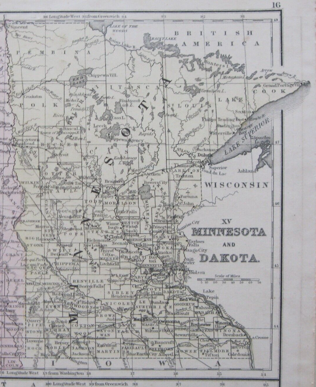
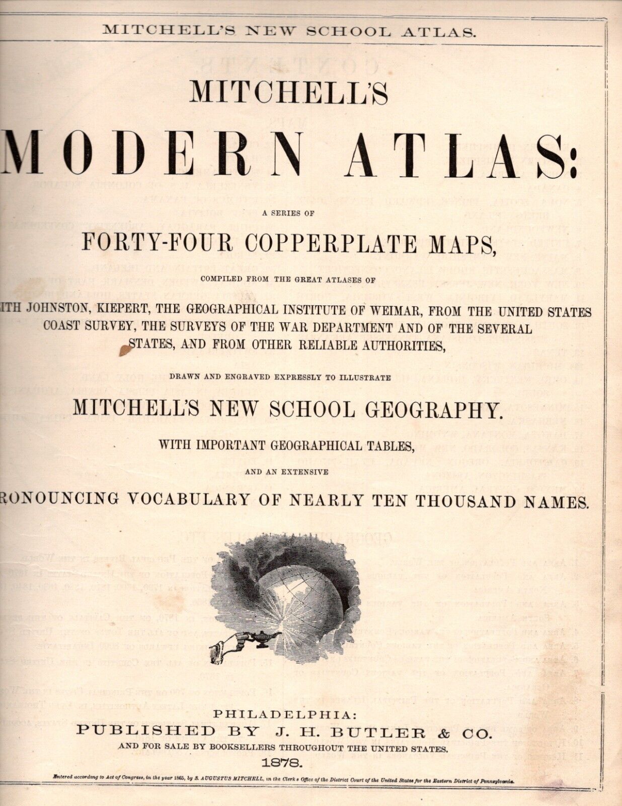
4 Mitchell Maps of 1870 Midwest-1.OH,K

US $44.95
or Best Offer
Condition:
“good-very sharp, bright and clean-double sided double folded”
- Buy It Now4 Mitchell Maps of 1870 Midwest-1.OH,KY,IN,IL,IA&MO-2.Dakota,MN-3.NE, 4.WI & MI
Oops! Looks like we're having trouble connecting to our server.
Refresh your browser window to try again.
Shipping:
US $9.25 USPS Ground Advantage®.
Located in: Bar Harbor, Maine, United States
Delivery:
Estimated between Sat, Oct 25 and Fri, Oct 31 to 94104
Returns:
Seller does not accept returns.
Payments:
.
Earn up to 5x points when you use your eBay Mastercard®. Learn moreabout earning points with eBay Mastercard
Shop with confidence
Seller assumes all responsibility for this listing.
eBay item number:355943757258
Item specifics
- Seller Notes
- “good-very sharp, bright and clean-double sided double folded”
- Date Range
- 1870-1880
- Format
- Atlas Map
- Printing Technique
- Copper Plate
- US State
- Illinois, Indiana, Iowa, Kentucky, Michigan, Minnesota, Missouri, Nebraska, Ohio, Wisconsin
- Year
- 1870
- U.S. Territories
- Dakota
- Size
- 9.2" x 11.5
- Original/Reproduction
- Antique Original
- Cartographer/Publisher
- Samuel Augustus Mitchell
- Publisher
- J. H. Butler & Co.
- Country/Region
- United States of America
Item description from the seller

Seller feedback (1,544)
- z***z (443)- Feedback left by buyer.Past monthVerified purchaseThis item arrived in great condition. The carefully wrapped item was securely packaged and arrived quickly. I am very pleased and recommend this seller.
- a***a (41)- Feedback left by buyer.Past 6 monthsVerified purchaseItem was well packaged and arrived in great condition.
- n***n (1451)- Feedback left by buyer.Past 6 monthsVerified purchaseWonderful eBayer. Flags pages arrived in great shape. Thank you108 Flags:50 US States w/dates of admission+58 Countries on 15 antique atlas pgs (#356418466817)
More to explore :
- IL, IN, MI, OH, WI Antique North America Atlas Maps,
- IL, IN, MI, OH, WI Antique North America Wall Maps,
- IL, IN, MI, OH, WI Antique North America County Maps,
- IL, IN, MI, OH, WI Antique North American Maps & Atlases,
- IL, IN, MI, OH, WI Antique North America City Maps,
- IL, IN, MI, OH, WI County Map Antique North America Atlas Maps,
- Woodcut IL, IN, MI, OH, WI Antique North American Maps & Atlases,
- Woodcut IL, IN, MI, OH, WI Antique North America Wall Maps,
- Vintage Reproduction IL, IN, MI, OH, WI Antique North American Maps & Atlases,
- Alvin Jewett Johnson IL, IN, MI, OH, WI Antique North American Maps & Atlases
Seller feedback (1,544)
- z***z (443)- Feedback left by buyer.Past monthVerified purchaseThis item arrived in great condition. The carefully wrapped item was securely packaged and arrived quickly. I am very pleased and recommend this seller.
- a***a (41)- Feedback left by buyer.Past 6 monthsVerified purchaseItem was well packaged and arrived in great condition.
- n***n (1451)- Feedback left by buyer.Past 6 monthsVerified purchaseWonderful eBayer. Flags pages arrived in great shape. Thank you108 Flags:50 US States w/dates of admission+58 Countries on 15 antique atlas pgs (#356418466817)