Picture 1 of 2

Picture 1 of 2

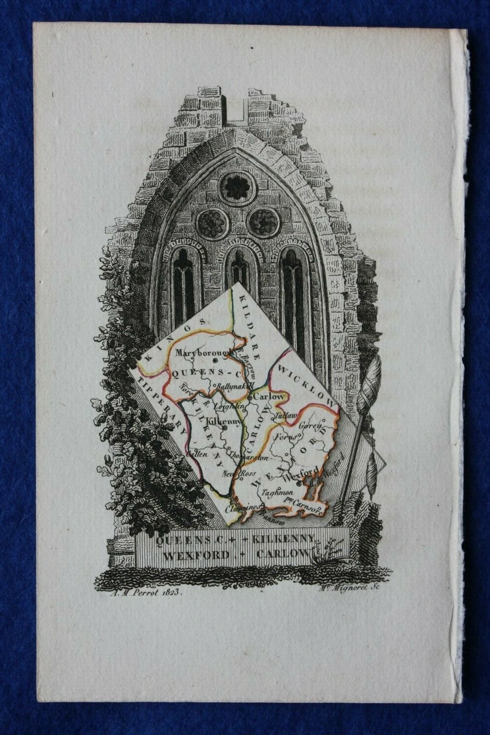
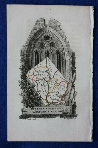
LAOIS, KILKENNY, WEXFORD, CARLOW, IRELAND antique minature map, Perrot, 1824

GBP 35.00
ApproximatelyUS $46.73
or Best Offer
Condition:
“Excellent condition. Slightly uneven edge to the sheet where it was once bound into the source ”... Read moreabout condition
Shipping:
GBP 9.50 (approx US $12.68) Royal Mail International Tracked.
International shipment of items may be subject to customs processing and additional charges.
Located in: Menston, West Yorkshire, United Kingdom
Delivery:
Estimated between Sat, Sep 28 and Thu, Oct 3 to 43230
Please allow additional time if international delivery is subject to customs processing.
Returns:
30 days returns. Buyer pays for return shipping.
Payments:
Earn up to 5x points when you use your eBay Mastercard®. Learn moreabout earning points with eBay Mastercard
Shop with confidence
Seller assumes all responsibility for this listing.
eBay item number:333451077721
Item specifics
- Seller Notes
- County
- Wexford, Carlow, Laois, Kilkenny
- Cartographer/Publisher
- Perrot / Depping
- Printing Technique
- Engraving
- Date Range
- 1800-1899
- Original/Reproduction
- Antique Original
- Country/Region
- Ireland
- Era
- 1800s
- Format
- Atlas Map
- Type
- County Map
- Year
- 1824
Item description from the seller

Seller feedback (2,391)
- 0***e (907)- Feedback left by buyer.Past 6 monthsVerified purchasePleasant, reliable seller with good communication and customer service skills offers beautiful antique prints at reasonable prices. Print arrived very promptly and safely, carefully protected and packaged. Highest quality, very accurately described by seller. Perfect!Antique print BATAVIA, JAKARTA, INDONESIA, CHILDREN'S HOSPITAL , Churchill, 1744 (#333537419952)
- _***1 (262)- Feedback left by buyer.Past monthVerified purchaseCame well packaged and just as described. Excellent seller A*
- e***e (511)- Feedback left by buyer.Past 6 monthsVerified purchaseItem arrived promptly, very well packaged and as described. Thank you. 5* seller, highly recommended.IRELAND, ENNISCORTHY, TAGHMON, WEXFORD, antique road map, Taylor & Skinner, 1783 (#235508663447)
More to explore :
- Antique European Maps & Atlases Ireland Wexford,
- Antique European Maps & Atlases Wexford,
- Ireland Antique Europe Maps & Atlases,
- Ireland Antique Europe Sheet Maps,
- Ireland Antique Europe Folding Maps,
- Ireland Antique Europe City Maps,
- Ireland Antique Europe County Maps,
- Dublin Ireland Antique Europe Atlas Maps,
- Ireland Dublin Antique Europe Atlas Maps,
- Antique European Maps & Atlases Cork Ireland