
Picture 1 of 8


Picture 1 of 8


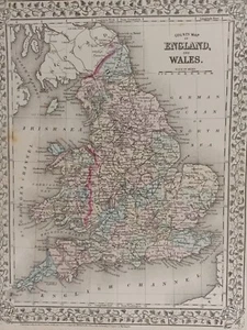
1873 Mitchell's Atlas County Map of England and Wales Authentic Hand-colored

US $75.00
or Best Offer
Was US $100.00 (25% off)
Condition:
“Very good condition with only slight wear or browning mostly along the edges. THIS MAP IS VERY ”... Read moreabout condition
Ended: May 11, 2024 04:42:04 PDT
Shipping:
Located in: Swampscott, Massachusetts, United States
Delivery:
Estimated between Fri, May 17 and Tue, May 21 to 43230
Returns:
Payments:
Special financing available. See terms and apply now- for PayPal Credit, opens in a new window or tab
Earn up to 5x points when you use your eBay Mastercard®. Learn moreabout earning points with eBay Mastercard
Shop with confidence
Seller assumes all responsibility for this listing.
eBay item number:325302307169
Item specifics
- Seller Notes
- Country/Region
- Wales
- Type
- County Map
- Format
- Atlas Map
- Year
- 1873
- Date Range
- 1800-1899
- Printing Technique
- Lithography
- Cartographer/Publisher
- Samuel Augustus Mitchell
- Original/Reproduction
- Antique Original
- County
- Anglesey, Angus/Forfarshire, Antrim, Argyll, Avon, Ayrshire, Banffshire, Bedfordshire
Item description from the seller
Seller assumes all responsibility for this listing.
eBay item number:325302307169
Shipping and handling
Item location:
Swampscott, Massachusetts, United States
Ships to:
Afghanistan, Albania, Algeria, Andorra, Angola, Anguilla, Antigua and Barbuda, Argentina, Armenia, Aruba, Australia, Austria, Azerbaijan Republic, Bahamas, Bahrain, Bangladesh, Belgium, Belize, Benin, Bermuda, Bhutan, Bolivia, Bosnia and Herzegovina, Botswana, Brazil, Brunei Darussalam, Bulgaria, Burkina Faso, Burundi, Cambodia, Cameroon, Canada, Cape Verde Islands, Cayman Islands, Central African Republic, Chad, Chile, China, Colombia, Costa Rica, Cyprus, Czech Republic, Côte d'Ivoire (Ivory Coast), Democratic Republic of the Congo, Denmark, Djibouti, Dominican Republic, Ecuador, Egypt, El Salvador, Equatorial Guinea, Eritrea, Estonia, Ethiopia, Fiji, Finland, France, Gabon Republic, Gambia, Georgia, Germany, Ghana, Gibraltar, Greece, Greenland, Grenada, Guatemala, Guinea, Guinea-Bissau, Guyana, Haiti, Honduras, Hong Kong, Hungary, Iceland, India, Indonesia, Ireland, Israel, Italy, Jamaica, Japan, Jordan, Kazakhstan, Kenya, Kiribati, Kuwait, Kyrgyzstan, Laos, Latvia, Lebanon, Lesotho, Liberia, Liechtenstein, Lithuania, Luxembourg, Macau, Macedonia, Madagascar, Malawi, Malaysia, Maldives, Mali, Malta, Mauritania, Mauritius, Mexico, Moldova, Monaco, Mongolia, Montenegro, Montserrat, Morocco, Mozambique, Namibia, Nauru, Nepal, Netherlands, New Zealand, Nicaragua, Niger, Nigeria, Norway, Oman, Pakistan, Panama, Papua New Guinea, Paraguay, Peru, Philippines, Poland, Portugal, Qatar, Republic of Croatia, Republic of the Congo, Romania, Rwanda, Saint Kitts-Nevis, Saint Lucia, Saint Vincent and the Grenadines, San Marino, Saudi Arabia, Senegal, Serbia, Seychelles, Sierra Leone, Singapore, Slovakia, Slovenia, Solomon Islands, South Africa, South Korea, Spain, Sri Lanka, Suriname, Swaziland, Sweden, Switzerland, Taiwan, Tajikistan, Tanzania, Thailand, Togo, Tonga, Trinidad and Tobago, Tunisia, Turkey, Turkmenistan, Turks and Caicos Islands, Uganda, United Arab Emirates, United Kingdom, United States, Uruguay, Uzbekistan, Vanuatu, Vatican City State, Vietnam, Wallis and Futuna, Western Samoa, Yemen, Zambia, Zimbabwe
Excludes:
Barbados, French Guiana, French Polynesia, Guadeloupe, Libya, Martinique, New Caledonia, Reunion, Russian Federation, Ukraine, Venezuela
| Shipping and handling | To | Service | Delivery*See Delivery notes |
|---|---|---|---|
| US $11.95 | United States | Economy Shipping | Estimated between Fri, May 17 and Tue, May 21 to 43230 |
| Handling time |
|---|
| Will usually ship within 3 business days of receiving cleared payment. |
| Taxes |
|---|
| Taxes may be applicable at checkout. Learn moreLearn more about paying tax on eBay purchases. |
Return policy
| After receiving the item, contact seller within | Refund will be given as | Return shipping |
|---|---|---|
| 30 days | Money Back | Buyer pays for return shipping |
Refer to eBay Return policyopens in a new tab or window for more details. You are covered by the eBay Money Back Guaranteeopens in a new tab or window if you receive an item that is not as described in the listing.
Payment details
Payment methods

More to explore :
- England County Map Antique Europe Atlas Maps,
- Wales Antique Europe County Maps,
- County Map Antique Atlas Maps,
- County Map Antique Atlas,
- Wales Antique Europe Atlas Maps,
- County Map Antique Africa Atlas Maps,
- Italy County Map Antique Europe Atlas Maps,
- Belgium County Map Antique Europe Atlas Maps,
- Ireland County Map Antique Europe Atlas Maps,
- Greece County Map Antique Europe Atlas Maps