Picture 1 of 4


Picture 1 of 4
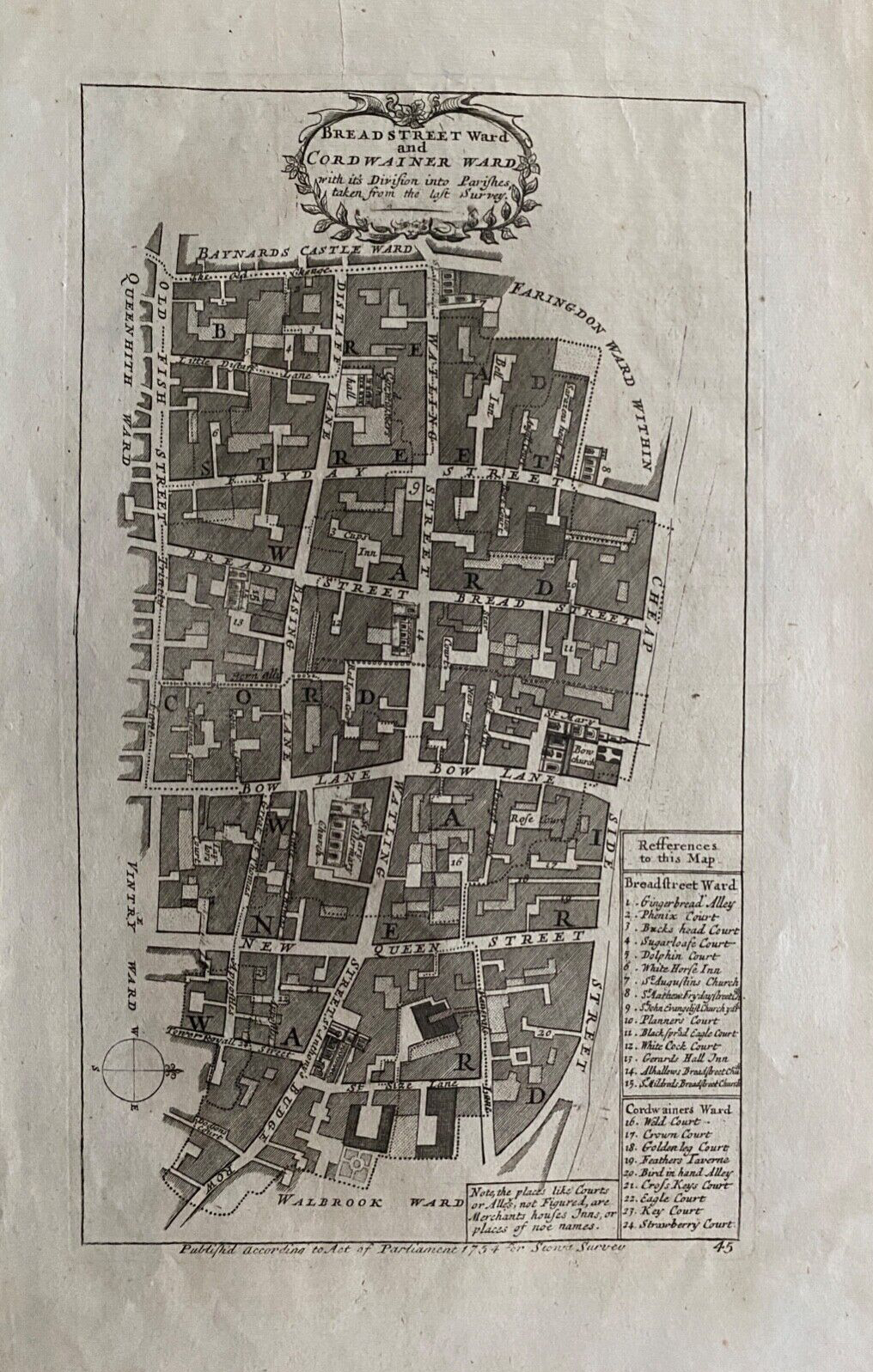


1754 Antique map: Breadstreet & Cordwainer Wards, London: Stow's Survey

GBP 64.99
ApproximatelyUS $86.91
Condition:
“Very good. Suitable for framing. Please check the scan for any blemishes prior to making your ”... Read moreabout condition
Shipping:
GBP 15.50 (approx US $20.73) Royal Mail International Standard.
International shipment of items may be subject to customs processing and additional charges.
Located in: Marlow, United Kingdom
Delivery:
Estimated between Mon, Sep 30 and Sat, Oct 5 to 43230
Please allow additional time if international delivery is subject to customs processing.
Returns:
30 days returns. Buyer pays for return shipping.
Payments:
Earn up to 5x points when you use your eBay Mastercard®. Learn moreabout earning points with eBay Mastercard
Shop with confidence
Seller assumes all responsibility for this listing.
eBay item number:295463545452
Item specifics
- Seller Notes
- Antique
- Yes
- Date Range
- 1700-1799
- Type
- City Map
- Printing Technique
- Copper Plate
- Format
- Atlas Map
- Year
- 1754
- Era
- 1700s
- Cartographer/Publisher
- Richard Blome
- Original/Reproduction
- Antique Original
- City
- London
- Country/Region
- United Kingdom
- County
- London
Item description from the seller

Seller feedback (13,418)
- 7***7 (55)- Feedback left by buyer.Past 6 monthsVerified purchaseGreat seller. Item exactly as described, sensibly priced, well packaged and arrived quickly. Would certainly buy from again.
- e***g (12)- Feedback left by buyer.Past monthVerified purchaseThe item came exactly as described. It was packaged perfectly, especially considering that it was shipped from the UK to the US. I’m incredibly pleased with my purchase and would buy from this seller again!
- g***a (910)- Feedback left by buyer.Past 6 monthsVerified purchaseReally good seller, everything was as described. Carefully packaged, arrived on time, product was in great condition, no problems. Can recommend this seller on basis of my experience 👍😊
More to explore :
- Antique Ordnance Survey Maps,
- Antique Europe Ordnance Survey Maps,
- Antique Original Antique Ordnance Survey Maps,
- Vintage Original Antique Ordnance Survey Maps,
- Antique Original Antique Europe Ordnance Survey Maps,
- London London Antique Europe Sheet Maps,
- London England London Antique Europe Maps & Atlases,
- London United Kingdom European Antique London Maps & Atlases,
- Antique European Maps & Atlases London,
- London Antique Europe City Maps