
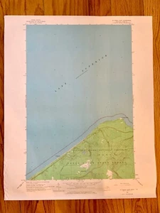
USGS michigan map 22 X 27vintage TOPOGRAPHIC AU SABLE POINT 1966 Pictured Rocks
US $15.00US $15.00
Tue, Sep 30, 07:33 PMTue, Sep 30, 07:33 PM
Picture 1 of 1
Gallery
Picture 1 of 1

Have one to sell?
USGS michigan map 22 X 27vintage TOPOGRAPHIC AU SABLE POINT 1966 Pictured Rocks
US $15.00
or Best Offer
Condition:
Oops! Looks like we're having trouble connecting to our server.
Refresh your browser window to try again.
Shipping:
US $4.95 USPS First Class®.
Located in: Leonard, Michigan, United States
Delivery:
Estimated between Thu, Nov 20 and Mon, Nov 24 to 94104
Returns:
30 days returns. Seller pays for return shipping.
Payments:
Special financing available. See terms and apply now- for PayPal Credit, opens in a new window or tab
Earn up to 5x points when you use your eBay Mastercard®. Learn moreabout earning points with eBay Mastercard
Shop with confidence
About this item
Seller assumes all responsibility for this listing.
eBay item number:267270415068
Item specifics
- Date Range
- 1960-1969
- Type
- Topographical Map
- US State
- Michigan
- Format
- Sheet Map
- Printing Technique
- Lithography
- Year
- 1966
- Original/Reproduction
- Vintage Original
- City
- Upper Peninsula
- Country/Region
- United States of America
Item description from the seller
Seller Feedback
No feedback yet
More to explore :
- Michigan Antique North America Topographical Maps,
- Michigan Topographical Map Antique North America Sheet Maps,
- Michigan Topographical Map Antique North America Folding Maps,
- Michigan Antique Original Antique North America Topographical Maps,
- Antique Topographical Maps,
- Lithography Antique Topographical Maps,
- Antique Asia Topographical Maps,
- Woodcut Antique Topographical Maps,
- Antique World Topographical Maps,
- Antique North America Topographical Maps