
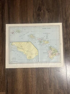
VTG 1900 Map Hawaiian Islands+Alaska 11X14.5”Antique Full Color 124yr Old Maps
US $17.00US $17.00
Mon, Oct 13, 10:56 AMMon, Oct 13, 10:56 AM
Picture 1 of 20


Gallery
Picture 1 of 20


Have one to sell?
VTG 1900 Map Hawaiian Islands+Alaska 11X14.5”Antiqu
US $17.00
or Best Offer
Condition:
Oops! Looks like we're having trouble connecting to our server.
Refresh your browser window to try again.
Shipping:
Free USPS Ground Advantage®.
Located in: Longton, Kansas, United States
Delivery:
Estimated between Thu, Nov 6 and Fri, Nov 14 to 94104
Returns:
Seller does not accept returns.
Payments:
Special financing available. See terms and apply now- for PayPal Credit, opens in a new window or tab
Earn up to 5x points when you use your eBay Mastercard®. Learn moreabout earning points with eBay Mastercard
Shop with confidence
Seller assumes all responsibility for this listing.
eBay item number:267186541842
Item specifics
- Date Range
- 1900-1909
- Type
- Antique turn of the century map suitable for framing
- US State
- Alaska, Hawaii
- Format
- Atlas Map
- Year
- 1900
- Original/Reproduction
- Antique Original
- Cartographer/Publisher
- National Standard
- City
- Juneau
- Country/Region
- US territory
Item description from the seller
Seller Feedback
No feedback yet
More to explore :
- Prince Edward Island Alaska Antique North America Maps & Atlases,
- Antique North American Maps & Atlases Alaska,
- Prince Edward Island Campeche Alaska Antique North American Maps & Atlases,
- Prince Edward Island Chiapas Alaska Antique North American Maps & Atlases,
- Prince Edward Island Colima Alaska Antique North American Maps & Atlases,
- Alaska Antique North America Railroad Maps,
- Alaska Antique North America Nautical Maps,
- Alaska Antique North America Maps & Atlases 1900-1909 Date Range,
- Alaska 1900-1909 Date Range Antique North America Folding Maps,
- Alaska Lithography Antique North America Folding Maps