Picture 1 of 10


Gallery
Picture 1 of 10


Have one to sell?
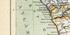
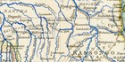
Africa Equator Colonies States Tribes Ancient Map Lithography circa 1891-

EUR 9.98
ApproximatelyUS $11.58
or Best Offer
Condition:
“Original antiker Druck, insgesamt gut erhalten.”
2 available
- Buy It NowAfrica Equator Colonies States Tribes Ancient Map Lithography circa 1891
Oops! Looks like we're having trouble connecting to our server.
Refresh your browser window to try again.
Shipping:
Does not ship to United States.
Located in: Göttingen, Germany
Delivery:
Varies
Returns:
Seller does not accept returns.
Payments:
Earn up to 5x points when you use your eBay Mastercard®. Learn moreabout earning points with eBay Mastercard
Shop with confidence
Seller assumes all responsibility for this listing.
eBay item number:266772850748
Item specifics
- Seller Notes
- “Original antiker Druck, insgesamt gut erhalten.”
- Motiv
- Landkarte
- Herstellungsmethode
- Lithografie
- Sprache
- Deutsch
- Erscheinungsjahr
- 1891
- Land/Region
- Äquatorial Afrika
- Bildausrichtung
- Querformat
- Breite
- 30,5 cm
- Höhe
- 25 cm
- Material
- Papier
- datiert
- ja
- Herstellungszeitraum
- 1850-1899
- Farbe
- mehrfarbig
- Herstellernummer
- 09010a
- Marke
- Brockhaus Konversationslexikon 14. Auflage 1892 - 1912
Item description from the seller
Seller business information
VAT number: DE 275183639

Popular categories from this store
Seller feedback (5,060)
- e***w (630)- Feedback left by buyer.Past 6 monthsVerified purchaseGut verpackt und schnell geliefert, die Karte entspricht der Beschreibung. Ihr Zustand ist gut. Ich bin zufrieden und empfehle den Verkäufer gerne weiter.Norddeutschland Nordsee Ostsee historische Landkarte Karte Lithographie ca. 1892 (#266774621481)
- r***e (2528)- Feedback left by buyer.Past monthVerified purchaseSchneller Versand ! 1A-Verpackung ! 1A-Artikel ! Top Verkäufer ! Danke !
- e***m (495)- Feedback left by buyer.Past monthVerified purchaseArtikel geliefert, wie beschrieben. Schnelle Lieferung und gute Verpackung. Danke
More to explore :
- Lithography Antique Africa Political Maps,
- Lithography Antique Africa Topographical Maps,
- Lithography Antique Africa Atlas Maps,
- Lithography Topographical Map Antique Africa Atlas Maps,
- South Africa Lithography Antique African Maps & Atlases,
- Lithography 1900-1909 Date Range Antique Africa Atlas Maps,
- Antique Africa Maps & Atlases,
- Lithography Topographical Map Antique Folding Maps,
- Lithography Geological Map Antique Atlas Maps,
- Lithography County Map Antique Atlas Maps
Popular categories from this store
Seller feedback (5,060)
- e***w (630)- Feedback left by buyer.Past 6 monthsVerified purchaseGut verpackt und schnell geliefert, die Karte entspricht der Beschreibung. Ihr Zustand ist gut. Ich bin zufrieden und empfehle den Verkäufer gerne weiter.Norddeutschland Nordsee Ostsee historische Landkarte Karte Lithographie ca. 1892 (#266774621481)
- r***e (2528)- Feedback left by buyer.Past monthVerified purchaseSchneller Versand ! 1A-Verpackung ! 1A-Artikel ! Top Verkäufer ! Danke !
- e***m (495)- Feedback left by buyer.Past monthVerified purchaseArtikel geliefert, wie beschrieben. Schnelle Lieferung und gute Verpackung. Danke