
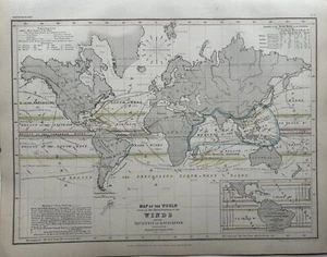
1850 Distribution Of World Winds Chart Hand Coloured Map By Augustus Petermann
GBP 24.99GBP 24.99
Tue, Sep 09, 10:55 PMTue, Sep 09, 10:55 PM
Picture 1 of 3


Gallery
Picture 1 of 3


Have one to sell?
1850 Distribution Of World Winds Chart Hand Coloured Map By Augustus Petermann
GBP 24.99
ApproximatelyUS $33.02
or Best Offer
Condition:
Oops! Looks like we're having trouble connecting to our server.
Refresh your browser window to try again.
Shipping:
GBP 12.00 (approx US $15.86) Parcelforce Global Express.
International shipment of items may be subject to customs processing and additional charges.
Located in: Manchester, United Kingdom
Delivery:
Estimated between Wed, Dec 17 and Mon, Dec 22 to 94104
Returns:
60 days returns. Seller pays for return shipping.
Payments:
Earn up to 5x points when you use your eBay Mastercard®. Learn moreabout earning points with eBay Mastercard
Shop with confidence
About this item
Seller assumes all responsibility for this listing.
eBay item number:256969705426
Item specifics
- Date Range
- 1800-1899
- Antique
- Yes
- Type
- Isothermic Line Map
- Format
- Atlas Map
- Year
- 1850
- Era
- 1800s
- Map View
- World
- Original/Reproduction
- Antique Original
- Cartographer/Publisher
- Augustus Petermann
Item description from the seller
Seller Feedback
No feedback yet
More to explore :
- C. Augustus Antique Maps, Atlases & Globes,
- Samuel Augustus Mitchell Antique County Maps,
- Samuel Augustus Mitchell Antique Atlas Maps,
- Antique European Maps & Atlases Samuel Augustus Mitchell,
- Samuel Augustus Mitchell Lithography Antique Atlas Maps,
- Samuel Augustus Mitchell Antique Original Antique County Maps,
- Samuel Augustus Mitchell Woodcut Antique Maps, Atlases & Globes,
- World Political Map Antique World Atlas Maps,
- World Antique World Folding Maps,
- World World Atlas Antique World Wall Maps