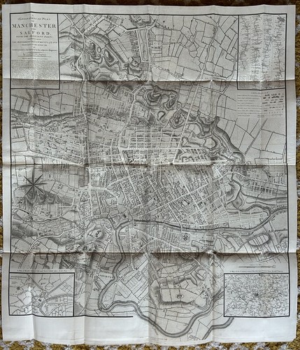
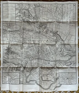
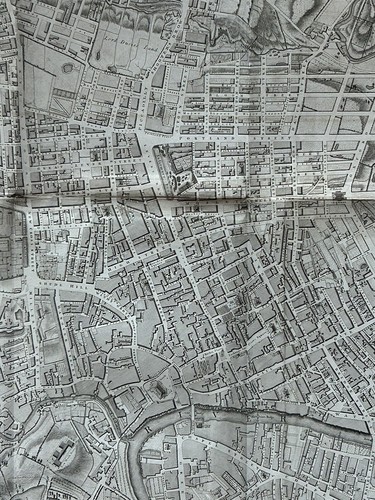
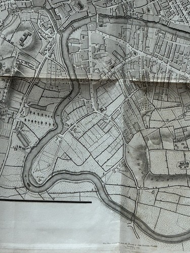
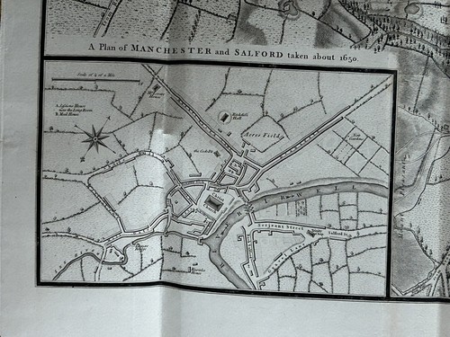
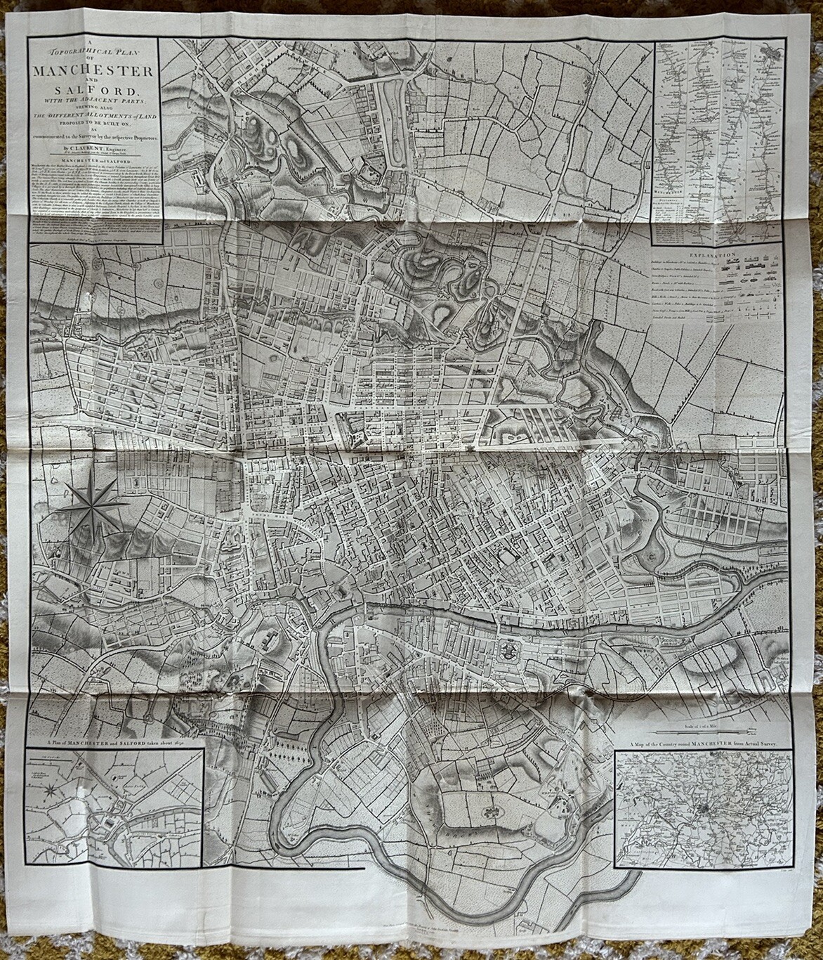
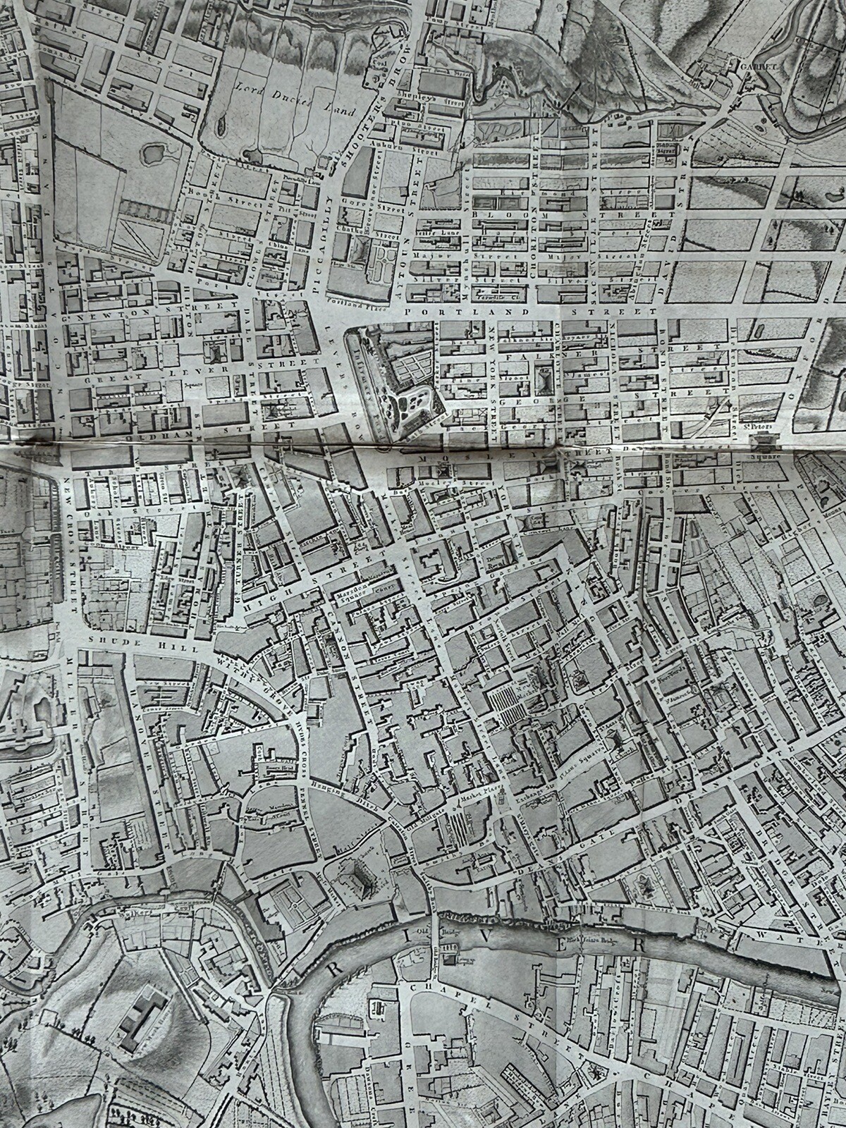
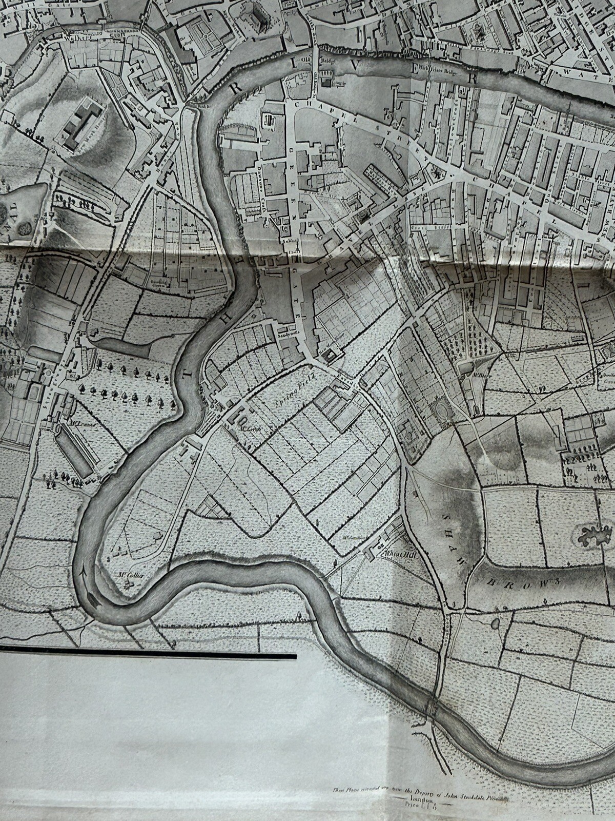
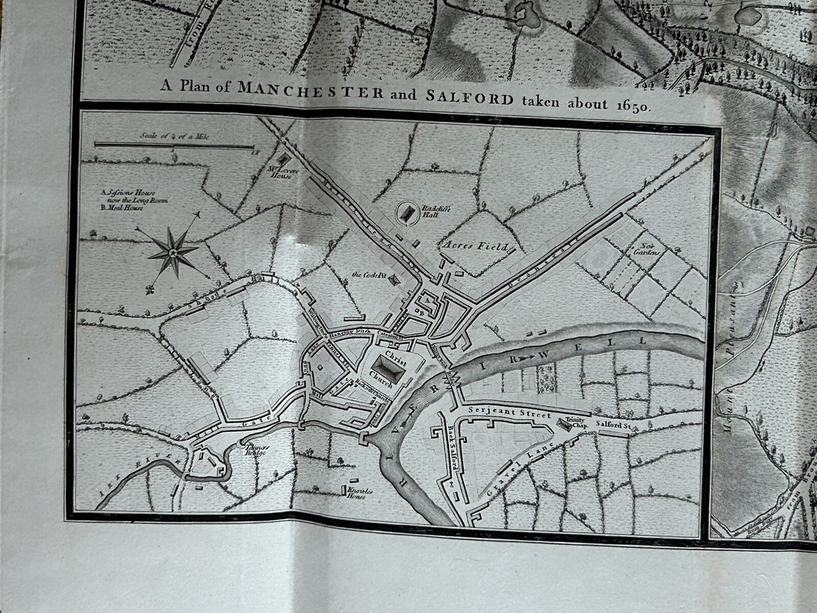
1793 Plan Manchester & Salford Large Folding Map by Charles Laurent 106 cm x 91
GBP 350.00GBP 350.00
Tue, Aug 05, 11:14 PMTue, Aug 05, 11:14 PM
Picture 1 of 17


Gallery
Picture 1 of 17


Have one to sell?
1793 Plan Manchester & Salford Large Folding Map by Charles Laurent 106 cm x 91
GBP 350.00
ApproximatelyUS $467.60
or Best Offer
Condition:
“The map is in good condition for its age.”
Oops! Looks like we're having trouble connecting to our server.
Refresh your browser window to try again.
Shipping:
GBP 5.00 (approx US $6.68) Royal Mail International Standard.
International shipment of items may be subject to customs processing and additional charges.
Located in: Manchester, United Kingdom
Delivery:
Estimated between Wed, Oct 15 and Fri, Oct 31 to 94104
Returns:
60 days returns. Seller pays for return shipping.
Payments:
Earn up to 5x points when you use your eBay Mastercard®. Learn moreabout earning points with eBay Mastercard
Shop with confidence
Seller assumes all responsibility for this listing.
eBay item number:256922448452
Item specifics
- Seller Notes
- “The map is in good condition for its age.”
- Date Range
- 1700-1799
- Antique
- Yes
- Type
- Road Map
- Format
- Folding Map
- Printing Technique
- Copper Plate
- Year
- 1793
- Era
- 1700s
- Cartographer/Publisher
- John Stockdale
- Original/Reproduction
- Antique Original
- City
- Manchester
- Country/Region
- England
- County
- Lancashire, Yorkshire
Item description from the seller
Seller Feedback
No feedback yet
More to explore :
- County Map Antique Folding Maps,
- Topographical Map Antique Folding Maps,
- Nautical Map Antique Folding Maps,
- River Map Antique Folding Maps,
- Geological Map Antique Folding Maps,
- County Map Antique World Folding Maps,
- Lithography Nautical Map Antique Folding Maps,
- Lithography Railroad Map Antique Folding Maps,
- Lithography Geological Map Antique Folding Maps,
- Antique World Folding Maps