Picture 1 of 6


Gallery
Picture 1 of 6


Have one to sell?
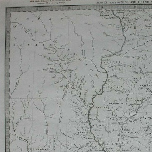
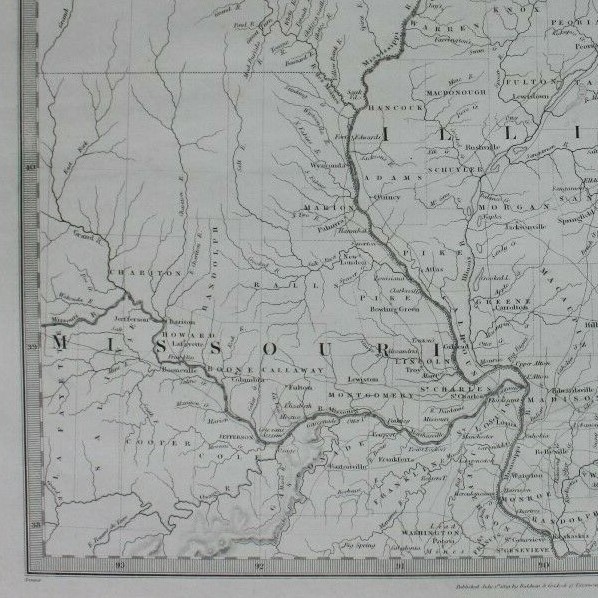
NORTH AMERICA IX, MISSOURI, ILLINOIS, INDIANA, original antique map, SDUK, 1844

GBP 44.00
ApproximatelyUS $57.82
or Best Offer
Condition:
“Very good condition. Light age toning. One or two faint age marks. Please study all the photographs ”... Read moreabout condition
- Buy It NowNORTH AMERICA IX, MISSOURI, ILLINOIS, INDIANA, original antique map, SDUK, 1844
Oops! Looks like we're having trouble connecting to our server.
Refresh your browser window to try again.
Shipping:
GBP 14.50 (approx US $19.05) Economy Int'l Postage.
Located in: Ilkley, United Kingdom
Delivery:
Estimated between Fri, Nov 7 and Mon, Dec 1 to 94104
Returns:
30 days returns. Buyer pays for return shipping. If you use an eBay shipping label, it will be deducted from your refund amount.
Payments:
Earn up to 5x points when you use your eBay Mastercard®. Learn moreabout earning points with eBay Mastercard
Shop with confidence
Seller assumes all responsibility for this listing.
eBay item number:235984171494
Item specifics
- Seller Notes
- US State
- Illinois
- Cartographer/Publisher
- SDUK
- Printing Technique
- Engraved
- Date Range
- 1800-1899
- Original/Reproduction
- Antique Original
- Country/Region
- United States of America
- Era
- 1800s
- Format
- Atlas Map
- Type
- Topographical Map
- Year
- 1844
Item description from the seller

Seller feedback (2,581)
- u***z (696)- Feedback left by buyer.Past monthVerified purchaseShipping - super fast. Packaging - professionally packed. Item - as described and in superb condition. Value - worth buying it. Trusted seller and business done smoothly.
- e***a (76)- Feedback left by buyer.Past yearVerified purchaseI am giving this purchase a 5-star rating, even though the map arrived more than a month late & the shipping tube had been severely mangled (no damage to the contents). Neither problem was the Seller's fault. The shipment was held by US Customs for a month (visible on the tracking documents) without explanation or contact. Seller remained in regular contact, offered to, and then refunded full purchase price during this hiatus. Upon successful delivery, Seller re-invoiced for the map, & I paid.Original antique atlas map BRITISH ISLES, GREAT BRITAIN, IRELAND, E Bowen, 1747 (#335916077525)
- 1***1 (707)- Feedback left by buyer.Past 6 monthsVerified purchaseReceived very quickly and well packaged. Item as described, excellent seller.N. IRELAND, NEWRY, CASTLEWELLAN, DUNDRUM antique road map, Taylor & Skinner 1778 (#336019391147)
More to explore :
- Missouri Antique Original Antique North America Maps & Atlases,
- Missouri Antique Original Antique North America County Maps,
- Missouri Antique Original Antique North America River Maps,
- Illinois Antique Original Antique North America Folding Maps,
- Illinois Antique Original Antique North America County Maps,
- Illinois Antique Original Antique North America River Maps,
- Illinois Antique Original Antique North America Topographical Maps,
- Illinois Antique Original Antique North America Railroad Maps,
- Illinois Vintage Original Antique North America Folding Maps,
- Indiana Antique Original Antique North America County Maps
Seller feedback (2,581)
- u***z (696)- Feedback left by buyer.Past monthVerified purchaseShipping - super fast. Packaging - professionally packed. Item - as described and in superb condition. Value - worth buying it. Trusted seller and business done smoothly.
- e***a (76)- Feedback left by buyer.Past yearVerified purchaseI am giving this purchase a 5-star rating, even though the map arrived more than a month late & the shipping tube had been severely mangled (no damage to the contents). Neither problem was the Seller's fault. The shipment was held by US Customs for a month (visible on the tracking documents) without explanation or contact. Seller remained in regular contact, offered to, and then refunded full purchase price during this hiatus. Upon successful delivery, Seller re-invoiced for the map, & I paid.Original antique atlas map BRITISH ISLES, GREAT BRITAIN, IRELAND, E Bowen, 1747 (#335916077525)
- 1***1 (707)- Feedback left by buyer.Past 6 monthsVerified purchaseReceived very quickly and well packaged. Item as described, excellent seller.N. IRELAND, NEWRY, CASTLEWELLAN, DUNDRUM antique road map, Taylor & Skinner 1778 (#336019391147)