
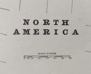
Vintage 1902 NORTH AMERICA Map 14"x22" Old Antique Original CANADA MEXICO USA
US $22.41US $22.41
Thu, Oct 02, 01:11 PMThu, Oct 02, 01:11 PM
Picture 1 of 8


Gallery
Picture 1 of 8


Have one to sell?
Vintage 1902 NORTH AMERICA Map 14"x22" Old Antique Original CANADA MEXICO USA
US $22.41
or Best Offer
Was US $33.95 (34% off)
Condition:
Ended: Oct 02, 2025 13:11:27 PDT
Oops! Looks like we're having trouble connecting to our server.
Refresh your browser window to try again.
Shipping:
Free USPS Ground Advantage®.
Located in: Augusta, Wisconsin, United States
Delivery:
Estimated between Mon, Oct 27 and Fri, Oct 31 to 94104
Returns:
30 days returns. Buyer pays for return shipping. If you use an eBay shipping label, it will be deducted from your refund amount.
Payments:
Special financing available. See terms and apply now- for PayPal Credit, opens in a new window or tab
Earn up to 5x points when you use your eBay Mastercard®. Learn moreabout earning points with eBay Mastercard
Shop with confidence
Seller assumes all responsibility for this listing.
eBay item number:235192575843
Item specifics
- Date Range
- 1900-1909
- Type
- Beautiful antique original map suitable for framing
- Format
- Atlas Map
- US State
- AL, FL, GA, MS, NC, SC, AR, IA, KS, LA, MO, NE, AZ, CA, CO, NM, NV, UT, CT, MA, ME, NH, RI, VT, DC, DE, MD, NJ, NY, PA, ID, OR, WA, IL, IN, MI, OH, WI, MN, MT, ND, SD, WY, VA, WV, KY, TN, OK, TX, AK, HI
- Mexican State
- Aguascalientes, Baja California, Baja California Sur, Chihuahua, Oaxaca, Sinaloa, Campeche, Chiapas, Coahuila, Colima, Durango, Guanajuato, Guerrero, Hidalgo, Jalisco, Michoacán, Morelos, Nayarit, Nuevo León, Puebla, Quintana Roo, Querétaro, San Luis Potosí, Sonora, Tabasco, Tamaulipas, Zacatecas, Yucatán, Veracruz, Tlaxcala
- Year
- 1902
- Canadian Province
- Ontario, British Columbia, Nova Scotia, Alberta, Manitoba, Newfoundland & Labrador, New Brunswick, Northwest Territories, Nunavut, Prince Edward Island, Quebec, Saskatchewan, Yukon
- Cartographer/Publisher
- George Cram
- Original/Reproduction
- Antique Original
- City
- Washington DC
- Country/Region
- Mexico United States Canada
- Country/Region of Manufacture
- United States
Item description from the seller
Seller Feedback
No feedback yet
More to explore :
- Mexico New Mexico Vintage Original Antique North America Maps & Atlases,
- Mexico Antique Original Antique North America Maps & Atlases,
- Mexico Antique Original Antique North America Atlas Maps,
- Canada Vintage Original Antique North America Maps & Atlases,
- New Mexico Vintage Original Antique North America Maps & Atlases,
- Mexico Antique North America Maps & Atlases,
- Mexico Antique North America Folding Maps,
- New Mexico Antique North America Maps & Atlases,
- Mexico Vintage Original Antique North American Maps & Atlases,
- Mexico City Antique North America Maps & Atlases