
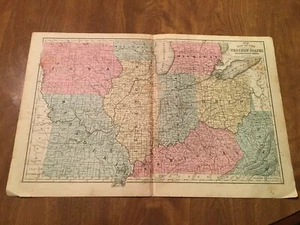
3 1863 MAPS-MICHIGAN & WISCONSIN & PARTS OF WESTERN STATES INCL WESTERN VA
US $50.00US $50.00
Fri, Aug 29, 01:27 PMFri, Aug 29, 01:27 PM
Picture 1 of 5


Gallery
Picture 1 of 5


Have one to sell?
3 1863 MAPS-MICHIGAN & WISCONSIN & PARTS OF WESTERN STATES INCL WESTERN VA

US $50.00
or Best Offer
Condition:
“3 1863 MAPS SALVAGE FROM SCHOOL GEOGRAPHY ORIGINAL-AS IS CONDITION-ALL MAPS ON ONE PAGE (TWO ”... Read moreabout condition
Oops! Looks like we're having trouble connecting to our server.
Refresh your browser window to try again.
Shipping:
US $9.50 USPS Priority Mail®.
Located in: Saint Paul, Minnesota, United States
Delivery:
Estimated between Sat, Sep 27 and Fri, Oct 3 to 94104
Returns:
Seller does not accept returns.
Payments:
.
Special financing available. See terms and apply now- for PayPal Credit, opens in a new window or tab
Earn up to 5x points when you use your eBay Mastercard®. Learn moreabout earning points with eBay Mastercard
Shop with confidence
Seller assumes all responsibility for this listing.
eBay item number:234992514905
Item specifics
- Seller Notes
- Date Range
- 1800-1899
- Type
- SALVAGE MAP 1863 ORIGINAL SCHOOL GEOGRAPHY
- Printing Technique
- HAND ENGRAVED HAND COLORED
- Format
- ONE PAGE 3 MAPS ORIG 1863
- US State
- PARTS OF WESTERN STATES INCLUDING WESTERN VA, STATE OF TX, MICHIGAN & WISCONSIN
- Canadian Province
- ONE PAGE TWO SIDES 3 MAPS ANTIQUE ORIG 1863
- Year
- 1863
- Cartographer/Publisher
- Rand McNally & Co.SYSTEM OF GEOGRAPHY MAP No 6
- Original/Reproduction
- Antique Original
- Country/Region
- United States of America
Item description from the seller

Seller Feedback
No feedback yet
More to explore :
- Western Hemisphere Physical Map Antique World Sheet Maps,
- Western Hemisphere Antique World Sheet Maps,
- Western Hemisphere Antique World Physical Maps,
- Western Hemisphere Antique World Atlas Maps,
- Western Hemisphere Antique World Maps & Atlases,
- Antique Wisconsin Maps & Atlases,
- Western Hemisphere Antique Original Antique World Sheet Maps,
- Antique North America Michigan Maps,
- United States of America Lithography Wisconsin Antique North American Maps & Atlases,
- Wisconsin Topographical Map Antique North America Folding Maps
Seller Feedback
No feedback yet