Picture 1 of 12


Gallery
Picture 1 of 12


Have one to sell?
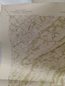
US&GS,USGS,TVA Quadrangle Map Of Jearoldstown Tennessee 1939 Edition.
US $20.00
Condition:
- Buy It NowUS&GS,USGS,TVA Quadrangle Map Of Jearoldstown Tennessee 1939 Edition.
Oops! Looks like we're having trouble connecting to our server.
Refresh your browser window to try again.
Shipping:
US $4.47 USPS Media MailTM.
Located in: Sevierville, Tennessee, United States
Delivery:
Estimated between Sat, Nov 15 and Fri, Nov 21 to 94104
Returns:
Seller does not accept returns.
Payments:
Special financing available. See terms and apply now- for PayPal Credit, opens in a new window or tab
Earn up to 5x points when you use your eBay Mastercard®. Learn moreabout earning points with eBay Mastercard
Shop with confidence
Seller assumes all responsibility for this listing.
eBay item number:233547083295
Item specifics
- Year
- 1939
- Format
- Folding Map
- Cartographer/Publisher
- Coast and Geodetic Survey
- Type
- Topographical Map
- Original/Reproduction
- Antique Original
- Date Range
- 1930-1939
- US State
- Tennessee
- Printing Technique
- Copper Plate
- City
- Jearoldstown
- Country/Region
- United States of America
Item description from the seller
Seller feedback (696)
- a***e (543)- Feedback left by buyer.More than a year agoVerified purchaseA++ Ultra fast shipping-well wrapped, as described, thank youThe Humane Society Members Shopping Bag (#233658610511)
- 1***6 (147)- Feedback left by buyer.More than a year agoVerified purchasePackaged well and arrived quickly. Love it - Thank you!Rae Dunn Flower Pot Footed "Lush / Fresh". (#233385135512)
- d***d- Feedback left by buyer.More than a year agoVerified purchaseGreat Seller, Fast ShipperGreg Norman Play Dry Men's Short Sleeve Golf Polo Shirt XXL White. (#233062547423)
More to explore :
- Tennessee Antique North America Maps & Atlases 1930-1939 Date Range,
- Tennessee Topographical Map Antique North America Folding Maps,
- Antique North American Maps & Atlases Tennessee,
- Tennessee Antique North America River Maps,
- Tennessee Antique North America Sheet Maps,
- Tennessee Antique North America Folding Maps,
- 1930-1939 Date Range Folding Map River Map Antique Maps, Atlases & Globes,
- Physical Map Sheet Map Antique 1930-1939 Date Range Maps, Atlases & Globes,
- Lithography Tennessee Antique North America Atlas Maps,
- 1930-1939 Date Range Antique School Maps