
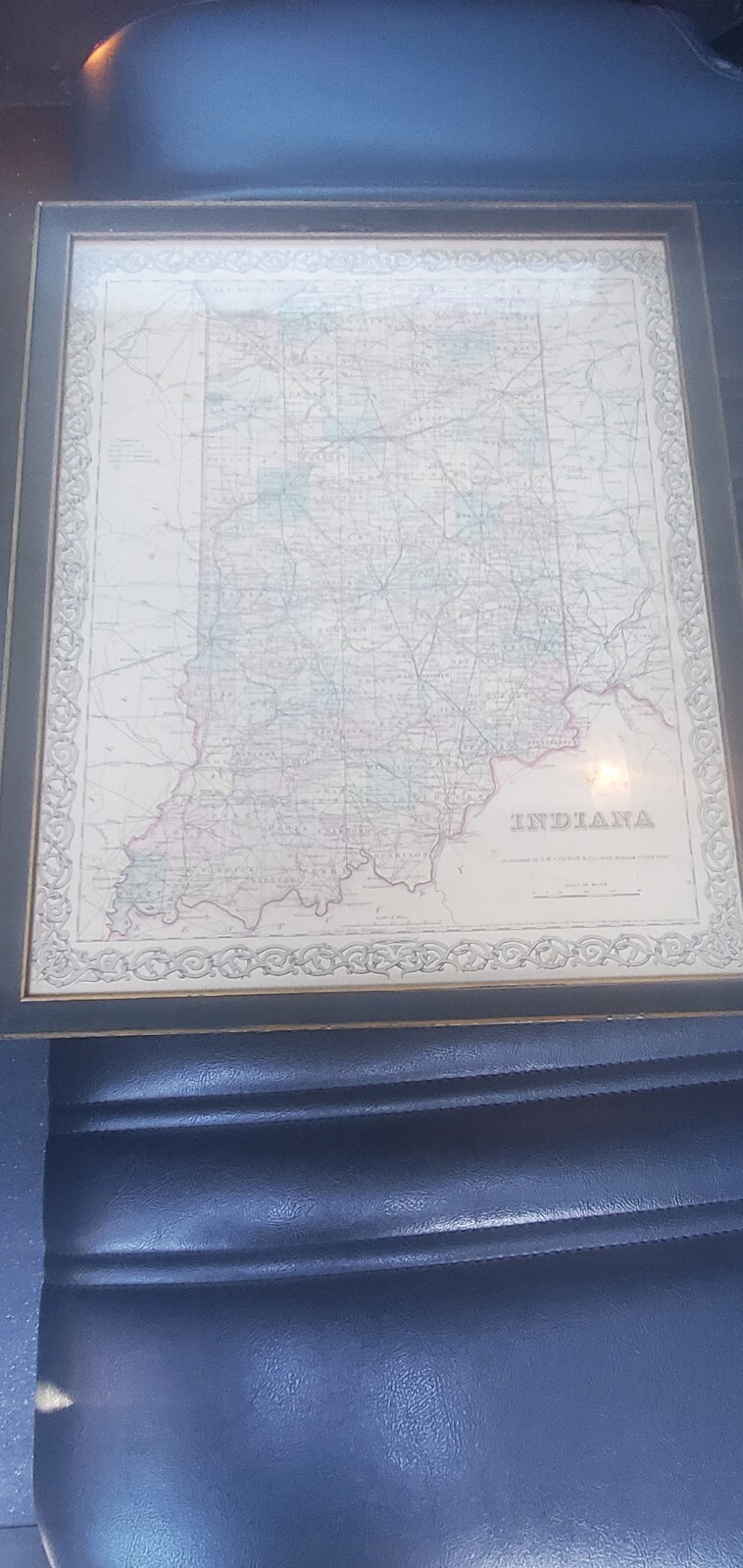
Colton's Maps, 1855, Authentic Indiana No.172
US $29.95US $29.95
Sun, Jul 20, 02:06 PMSun, Jul 20, 02:06 PM
Picture 1 of 4


Gallery
Picture 1 of 4


Have one to sell?
Colton's Maps, 1855, Authentic Indiana No.172

Condition:
Ended: Jul 20, 2025 14:06:29 PDT
Oops! Looks like we're having trouble connecting to our server.
Refresh your browser window to try again.
Shipping:
US $11.71 USPS Ground Advantage®.
Located in: Kennett Square, Pennsylvania, United States
Delivery:
Estimated between Thu, Sep 25 and Wed, Oct 1 to 94104
Returns:
Seller does not accept returns.
Payments:
Special financing available. See terms and apply now- for PayPal Credit, opens in a new window or tab
Earn up to 5x points when you use your eBay Mastercard®. Learn moreabout earning points with eBay Mastercard
Shop with confidence
Seller assumes all responsibility for this listing.
eBay item number:226864645597
Item specifics
- Date Range
- 1800-1899
- Type
- County Map
- US State
- Indiana
- Format
- Atlas Map
- Year
- 1855
- Original/Reproduction
- Original
- Cartographer/Publisher
- Joseph Colton
- Country/Region
- United States of America
Item description from the seller

Seller Feedback
No feedback yet
More to explore :
- Joseph Colton Antique Atlas Maps,
- Joseph Colton Antique Maps, Atlases & Globes,
- Joseph Colton Antique Original Antique Atlas Maps,
- Joseph Colton Antique North America Atlas Maps,
- Antique North American Maps & Atlases Joseph Colton,
- Antique North American Maps & Atlases Indiana,
- Joseph Colton Antique Original Antique Maps, Atlases & Globes,
- Indiana Antique North America County Maps,
- Indiana Antique North America City Maps,
- Lithography Indiana Antique North America County Maps
Seller Feedback
No feedback yet