
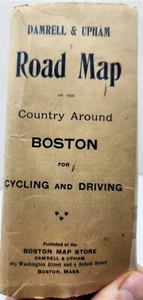
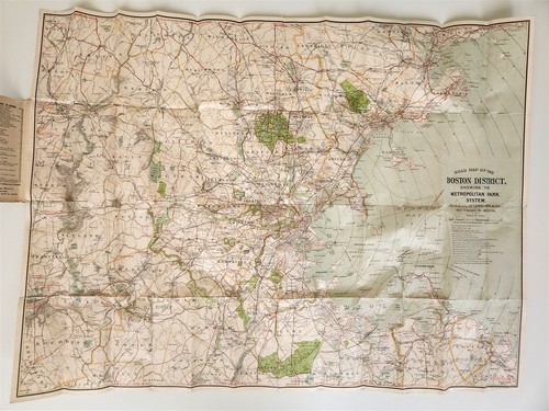
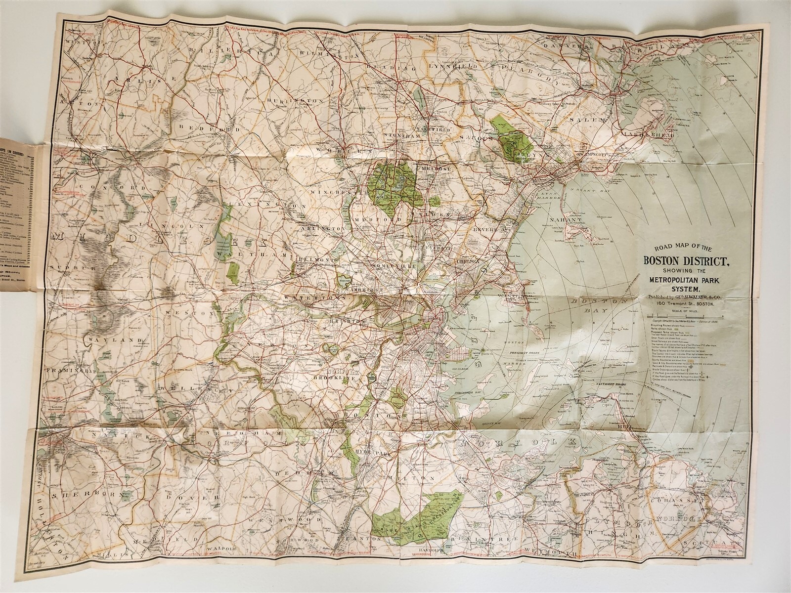
1898 Damrell & Upham Cycling & Driving Road Map of the Country Around Boston B2
US $47.81US $47.81
Mon, Oct 06, 08:50 AMMon, Oct 06, 08:50 AM
Picture 1 of 12


Gallery
Picture 1 of 12


Have one to sell?
1898 Damrell & Upham Cycling & Driving Road Map of the Country Around Boston B2
US $47.81
or Best Offer
Was US $63.75 (25% off)
Condition:
“Moderate wear for age. Some small tears on fold lines, many repaired with archival tape, please see ”... Read moreabout condition
Ended: Oct 06, 2025 08:50:58 PDT
Oops! Looks like we're having trouble connecting to our server.
Refresh your browser window to try again.
Shipping:
US $5.00 USPS First Class®.
Located in: Sacramento, California, United States
Delivery:
Estimated between Tue, Dec 9 and Fri, Dec 12 to 94104
Returns:
30 days returns. Seller pays for return shipping.
Payments:
.
Special financing available. See terms and apply now- for PayPal Credit, opens in a new window or tab
Earn up to 5x points when you use your eBay Mastercard®. Learn moreabout earning points with eBay Mastercard
Shop with confidence
About this item
Seller assumes all responsibility for this listing.
eBay item number:226272002754
Item specifics
- Seller Notes
- US State
- Massachusetts
- City
- Boston
- Type
- County Map
- Format
- Folding Map
- Original/Reproduction
- Antique Original
Item description from the seller
Seller Feedback
No feedback yet
More to explore :
- Boston Road Atlas Antique North America Atlas Maps,
- Boston City Map Antique North America Atlas Maps,
- Boston River Map Antique North America Atlas Maps,
- Boston County Map Antique North America Atlas Maps,
- Boston Antique North America City Maps,
- Boston Antique North America Railroad Maps,
- Boston Lithography Antique North American Maps & Atlases,
- Boston Massachusetts Antique North America Railroad Maps,
- Boston Maine Antique North America Atlas Maps,
- Boston Antique North America Road Atlas