Picture 1 of 6


Picture 1 of 6
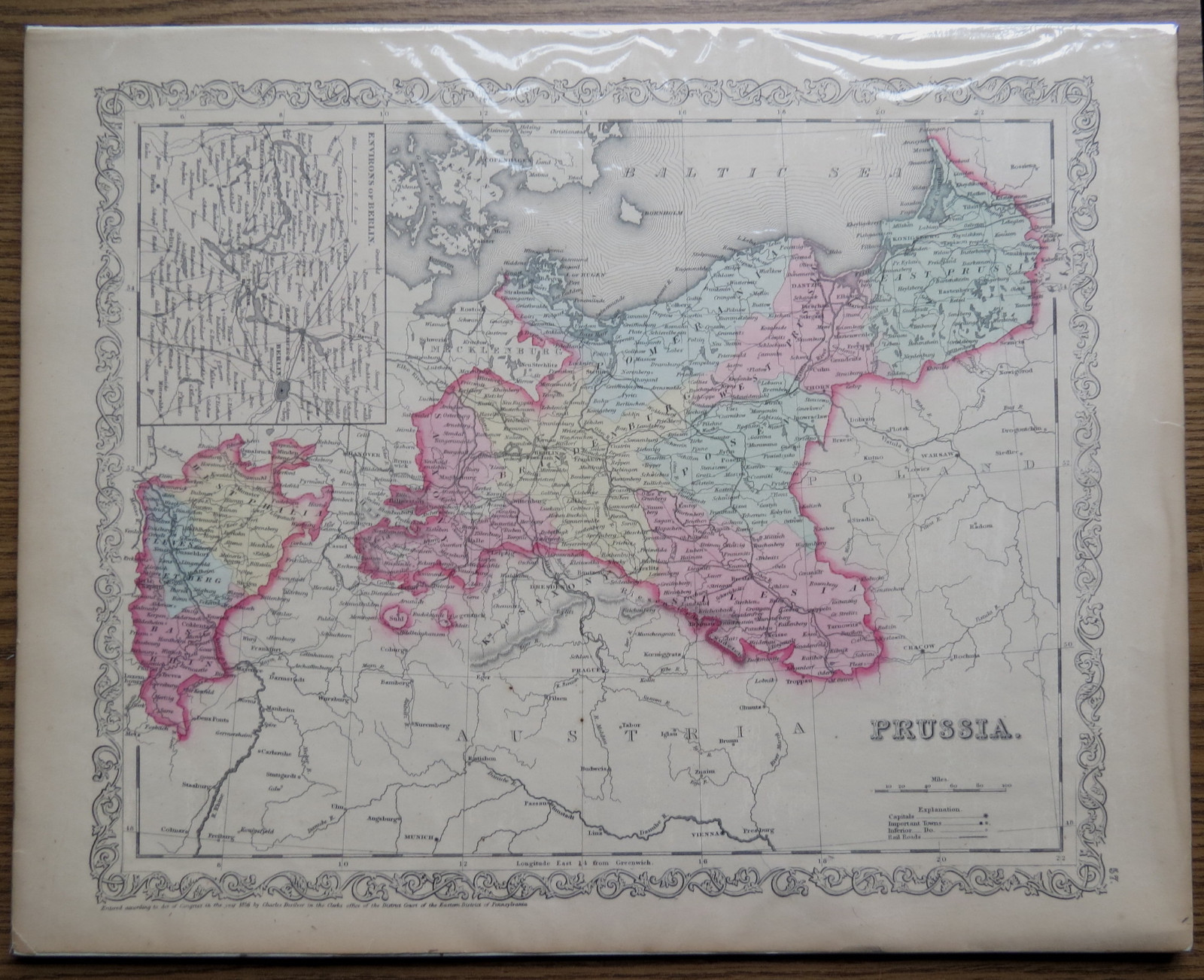


1856 CHARLES DESILVER MAP of PRUSSIA - Hand Colored Original

US $45.00
Condition:
“Good”
Shipping:
US $6.50 USPS First Class®.
Located in: Norristown, Pennsylvania, United States
Delivery:
Estimated between Thu, Sep 26 and Sat, Sep 28 to 43230
Returns:
Seller does not accept returns.
Payments:
Special financing available. See terms and apply now- for PayPal Credit, opens in a new window or tab
Earn up to 5x points when you use your eBay Mastercard®. Learn moreabout earning points with eBay Mastercard
Shop with confidence
Seller assumes all responsibility for this listing.
eBay item number:226091281066
Item specifics
- Seller Notes
- “Good”
- Date Range
- 1800-1899
- Type
- World Atlas
- Format
- Atlas Map
- Printing Technique
- engraving
- Year
- 1856
- State
- All
- Cartographer/Publisher
- Charles Desilver
- Original/Reproduction
- Antique Original
- City
- Berlin
- Country/Region
- Germany, Prussia
- County
- Prussia
Item description from the seller

Seller feedback (6,960)
- .***g (1505)- Feedback left by buyer.Past 6 monthsVerified purchasePositive seller communications. Nice piece, reasonably priced, shipped well. Recommend.BEAUTIFUL 14 K YELLOW GOLD LOOP & PEARL DANGLE EARRINGS - GL (#225946207161)
- e***2 (1189)- Feedback left by buyer.Past yearVerified purchaseDelightful experience to do business with this seller—thank you for the kind note wishing for my enjoyment of the engraving, and indeed I am so happy to have discovered and purchased it! More than reasonable pricing, conscientious packaging, quickest possible shipping and delivery—thank you! Highly recommended vendor!THE HUNT LUNCH - Carle Van Loo - Old Litho Print (#275963774123)
- e***n (1175)- Feedback left by buyer.Past 6 monthsVerified purchaseWrapped well, exactly as described , shipped quickly ! Thank you !SNUFF BOXES EUROPEAN & AMERICAN 1730-1830 CLARE LE CORBEILLER 1966 (#275957201959)
More to explore :
- Prussia Antique Original Antique European Maps & Atlases,
- Prussia Antique Europe Atlas Maps,
- Antique European Maps & Atlases Prussia,
- Prussia Antique Europe Political Maps,
- Prussia Copper Plate Antique Original Antique European Maps & Atlases,
- Antique European Maps & Atlases Saxony Prussia,
- Prussia 1800-1899 Date Range Antique Europe Political Maps,
- Antique European Maps & Atlases 1800-1899 Date Range Prussia,
- Prussia Saxony 1800-1899 Date Range Antique Europe Maps & Atlases,
- Antique Original Topographical Map Antique Wall Maps