Picture 1 of 18


Gallery
Picture 1 of 18


Have one to sell?
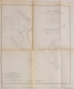
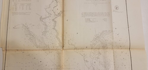
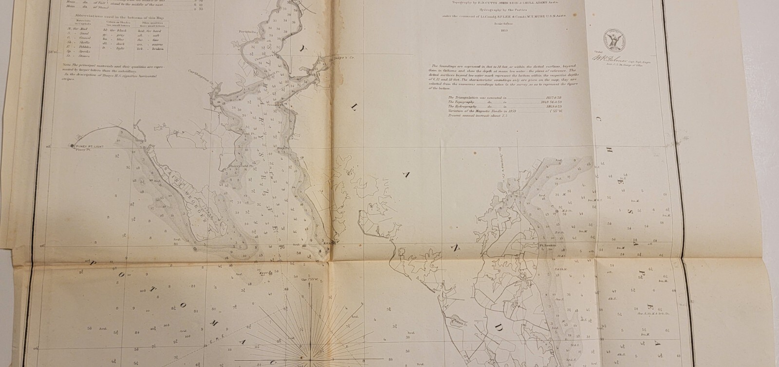
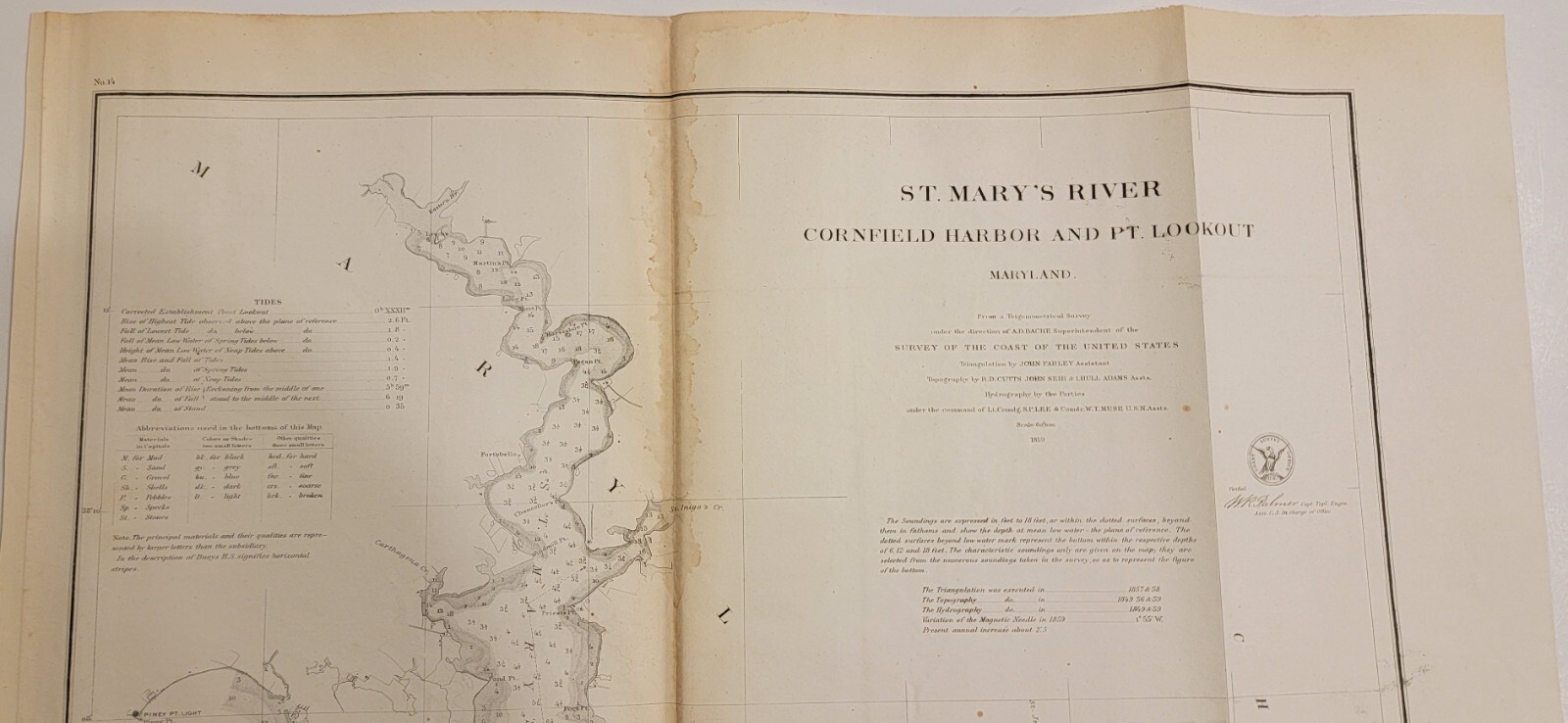
1859 U.S. Coast Survey chart map St. Mary's River Cornfield Harbor Pt. Lookout
US $60.00
or 4 interest-free payments of $15.00 available with
Condition:
- Buy It Now1859 U.S. Coast Survey chart map St. Mary's River Cornfield Harbor Pt. Lookout
Oops! Looks like we're having trouble connecting to our server.
Refresh your browser window to try again.
Shipping:
Free USPS Ground Advantage®.
Located in: Lafayette, Colorado, United States
Delivery:
Estimated between Wed, Oct 1 and Mon, Oct 6 to 94104
Returns:
Seller does not accept returns.
Payments:
.
Special financing available. See terms and apply now- for PayPal Credit, opens in a new window or tab
Earn up to 5x points when you use your eBay Mastercard®. Learn moreabout earning points with eBay Mastercard
Shop with confidence
Seller assumes all responsibility for this listing.
eBay item number:197264496655
Item specifics
- Date Range
- 1850-1899
- Type
- Nautical chart
- Format
- Folding Map
- Printing Technique
- Lithography
- US State
- Maryland
- Year
- 1859
- Original/Reproduction
- Antique Original
- Cartographer/Publisher
- A. D. Bache
- City
- Cornfield Harbor
- Country/Region
- United States of America
Item description from the seller
Seller feedback (94)
- e***v (2115)- Feedback left by buyer.Past monthVerified purchaseItem as described. Packaged well, shipped quickly. Great seller.
- i***r (87)- Feedback left by buyer.Past monthVerified purchaseExactly as described, packaged well, and shipped fast
- a***a (26)- Feedback left by buyer.Past 6 monthsVerified purchaseGreat packaging, came on time, exactly as stated. Thank you.
More to explore :
- Antique Ordnance Survey Maps,
- Antique Europe Ordnance Survey Maps,
- St. Louis Antique North America River Maps,
- Vintage Original Antique Ordnance Survey Maps,
- Antique Original Antique Ordnance Survey Maps,
- Antique Asia River Maps,
- Lithography River Map Antique Atlas Maps,
- Lithography River Map Antique Sheet Maps,
- Antique Europe River Maps,
- Antique Original River Map Antique Folding Maps