
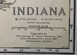
1952 Vintage State Maps of Indiana and Iowa
US $10.86US $10.86
Mon, Oct 06, 12:19 PMMon, Oct 06, 12:19 PM
Picture 1 of 4


Gallery
Picture 1 of 4


Have one to sell?
1952 Vintage State Maps of Indiana and Iowa
US $10.86
Condition:
“Super Clean, Map is Near Mint. Clean bright and tight. 11" X 15" Full Page sheet, with margins, maps ”... Read moreabout condition
Oops! Looks like we're having trouble connecting to our server.
Refresh your browser window to try again.
Shipping:
US $5.65 Economy Shipping.
Located in: Wilmington, North Carolina, United States
Delivery:
Estimated between Tue, Oct 21 and Sat, Oct 25 to 94104
Returns:
14 days returns. Buyer pays for return shipping. If you use an eBay shipping label, it will be deducted from your refund amount.
Payments:
Special financing available. See terms and apply now- for PayPal Credit, opens in a new window or tab
Earn up to 5x points when you use your eBay Mastercard®. Learn moreabout earning points with eBay Mastercard
Shop with confidence
Seller assumes all responsibility for this listing.
eBay item number:197187278967
Item specifics
- Seller Notes
- Date Range
- 1950-1959
- Printing Technique
- Lithography
- Format
- Atlas Map
- US State
- Indiana, Iowa
- Year
- 1952
- Original/Reproduction
- Antique Original
- Cartographer/Publisher
- George Cram
Item description from the seller
Seller Feedback
No feedback yet
This is a private listing and your identity will not be disclosed to anyone except the seller.
More to explore :
- United States of America Iowa Antique North America Railroad Maps,
- United States of America Iowa Antique North America Topographical Maps,
- United States of America Iowa Antique North America City Maps,
- United States of America Iowa Antique North America Maps & Atlases,
- United States of America Iowa Antique North America County Maps,
- Vintage Reproduction Iowa Antique North America County Maps,
- Antique North American Maps & Atlases Iowa,
- United States of America Lithography Indiana Antique North American Maps & Atlases,
- Iowa Antique North America County Maps,
- Iowa Antique North America Wall Maps