
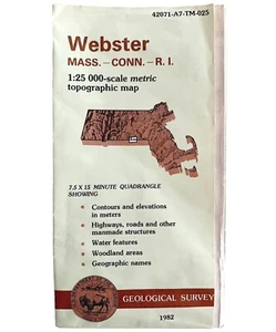
Map Webster Mass CT RI Geological Topographic Survey 1982 24 x 38" DWX6A
US $29.99US $29.99
Mon, Aug 04, 05:42 AMMon, Aug 04, 05:42 AM
Picture 1 of 3


Gallery
Picture 1 of 3


Have one to sell?
Map Webster Mass CT RI Geological Topographic Survey 1982 24 x 38" DWX6A
US $29.99
or Best Offer
Condition:
Oops! Looks like we're having trouble connecting to our server.
Refresh your browser window to try again.
Shipping:
US $9.25 USPS First Class®.
Located in: Cambridge, Maine, United States
Delivery:
Estimated between Mon, Oct 20 and Sat, Oct 25 to 94104
Returns:
30 days returns. Seller pays for return shipping.
Payments:
Special financing available. See terms and apply now- for PayPal Credit, opens in a new window or tab
Earn up to 5x points when you use your eBay Mastercard®. Learn moreabout earning points with eBay Mastercard
Shop with confidence
Seller assumes all responsibility for this listing.
eBay item number:187342814425
Item specifics
- US State
- Massachusetts, Connecticut, Rhode Island
- Printing Technique
- Lithography
- Cartographer/Publisher
- NA
- City
- Webster
- California Prop 65 Warning
- NA
- Date Range
- 1980-1989
- Type
- Topographical Map
- Format
- Folding Map
- Mexican State
- NA
- Year
- 1982
- Canadian Province
- NA
- Original/Reproduction
- Vintage Original
- Country/Region
- United States of America
Item description from the seller
Seller Feedback
No feedback yet
More to explore :
- CT, MA, ME, NH, RI, VT Antique North America Geological Maps,
- CT, MA, ME, NH, RI, VT Topographical Map Antique North America Sheet Maps,
- CT, MA, ME, NH, RI, VT Antique North America Topographical Maps,
- Antique Geological Maps,
- CT, MA, ME, NH, RI, VT Antique Original Antique North America Topographical Maps,
- Antique Ordnance Survey Maps,
- United States of America CT, MA, ME, NH, RI, VT Antique North America Topographical Maps,
- Antique Asia Geological Maps,
- Antique North America Geological Maps,
- Lithography Geological Map Antique Folding Maps