
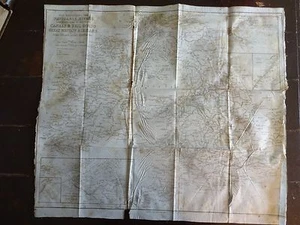
1843 Map of the Navigable Rivers, Canals & Railroads of Great Britain & Ireland
GBP 148.98GBP 148.98
Sun, Oct 05, 11:58 AMSun, Oct 05, 11:58 AM
Picture 1 of 10


Gallery
Picture 1 of 10


Have one to sell?
1843 Map of the Navigable Rivers, Canals & Railroads of Great Britain & Ireland
GBP 148.98
ApproximatelyUS $196.22
or Best Offer
Condition:
Oops! Looks like we're having trouble connecting to our server.
Refresh your browser window to try again.
Shipping:
Does not ship to United States.
Located in: Rockville, Maryland, United States
Delivery:
Varies
Returns:
30 days returns. Buyer pays for return shipping. If you use an eBay shipping label, it will be deducted from your refund amount.
Payments:
Earn up to 5x points when you use your eBay Mastercard®. Learn moreabout earning points with eBay Mastercard
Shop with confidence
About this item
Seller assumes all responsibility for this listing.
eBay item number:323443599344
Item specifics
- Type
- Map
- Original/Reproduction
- Original
- Brand
- Unbranded
Item description from the seller
Seller Feedback
No feedback yet
More to explore :
- Ireland Antique Europe Sheet Maps,
- Ireland Antique Europe Atlas Maps,
- Ireland County Map Antique Europe Atlas Maps,
- Ireland Antique Europe City Maps,
- Ireland Antique Europe Folding Maps,
- River Map Antique Wall Maps,
- Ireland Wicklow Antique Europe County Maps,
- Ireland Meath Antique Europe County Maps,
- Dublin Ireland Antique Europe Atlas Maps,
- Ireland Lithography Antique Europe County Maps