


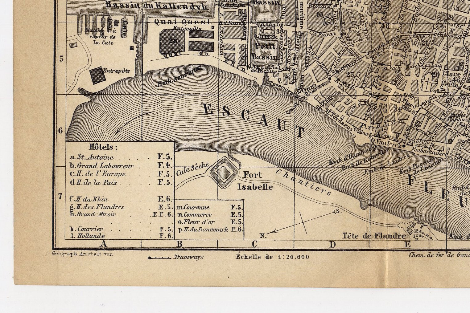

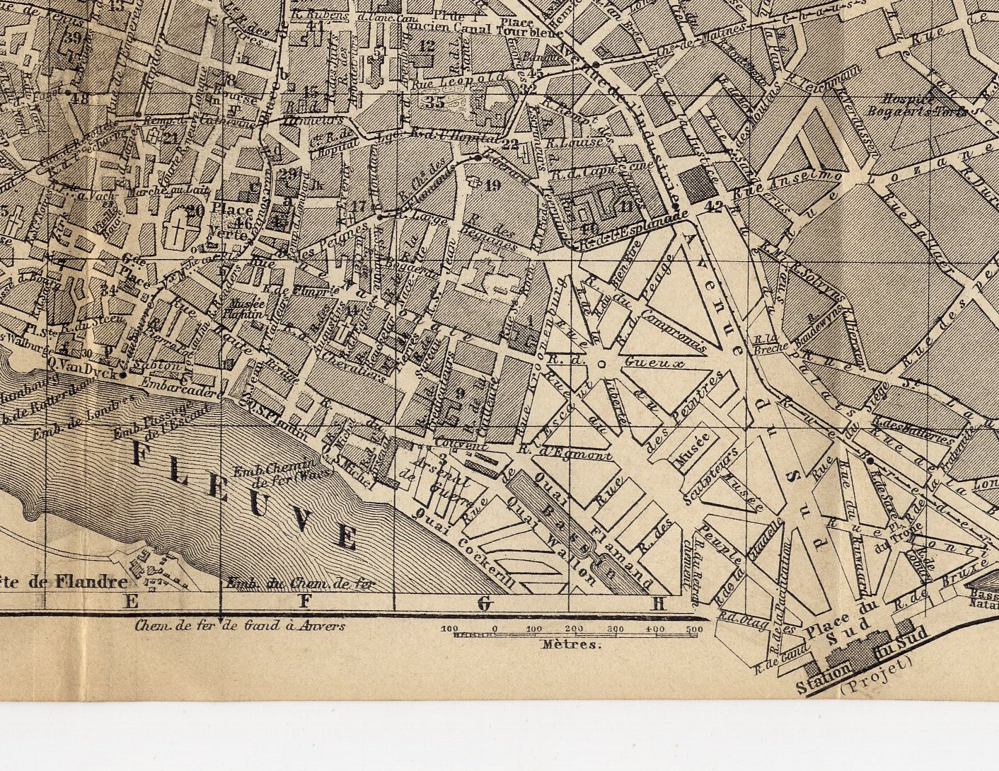

1881 ANTIQUE CITY MAP OF ANTWERP / ANTWERPEN / ANVERS / BELGIUM
US $30.37
or Best Offer
Condition:
“GOOD / SIZE: 10 3/4" x 6" (27 x 15 cm). ATTENTION: FOLDED SEVERAL TIMES, AS ORIGINALLY ISSUED! ”... Read moreabout condition
Oops! Looks like we're having trouble connecting to our server.
Refresh your browser window to try again.
Shipping:
Free Standard Shipping from Canada.
International shipment of items may be subject to customs processing and additional charges.
Located in: Montreal, Quebec, Canada
Delivery:
Estimated between Tue, May 13 and Mon, May 19 to 43230
Please allow additional time if international delivery is subject to customs processing.
Returns:
60 days returns. Seller pays for return shipping.
Payments:
Special financing available. See terms and apply now- for PayPal Credit, opens in a new window or tab
Earn up to 5x points when you use your eBay Mastercard®. Learn moreabout earning points with eBay Mastercard
Shop with confidence
Seller assumes all responsibility for this listing.
eBay item number:156747909580
Item specifics
- Seller Notes
- Date Range
- 1800-1899
- Type
- City Map
- Year
- 1881
- City
- Antwerp
- Country/Region
- Belgium
Item description from the seller
Seller Feedback
No feedback yet
More to explore :
- Belgium Antwerp Antique Europe City Maps,
- Antique European Maps & Atlases Antwerp Belgium,
- Antwerp Antique Europe City Maps,
- Belgium Antwerp Antique Original Antique European Maps & Atlases,
- Belgium Antique Europe City Maps,
- Brussels Belgium Antique Europe City Maps,
- Belgium Antwerp Antique European Maps & Atlases 1600-1699 Date Range,
- Belgium 1600-1699 Date Range Antique Europe City Maps,
- Belgium 1800-1899 Date Range Antique Europe City Maps,
- Brussels Belgium Antique Original Antique European Maps & Atlases