Picture 1 of 4


Picture 1 of 4


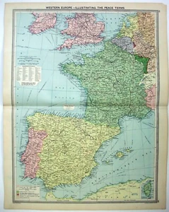
Western Europe Showing the WWI Peace Terms - Original 1926 Map by George Philip.

US $22.00
Condition:
“A small piece missing from the tip of the right corner - highlighted in the 3rd photo, minor wear, ”... Read moreabout condition
Shipping:
Free 2-4 day shipping
Get it between Fri, Sep 27 and Mon, Sep 30 to 43230.
Located in: Sayville, New York, United States
Returns:
30 days returns. Seller pays for return shipping.
Payments:
Special financing available. See terms and apply now- for PayPal Credit, opens in a new window or tab
Earn up to 5x points when you use your eBay Mastercard®. Learn moreabout earning points with eBay Mastercard
Shop with confidence
Seller assumes all responsibility for this listing.
eBay item number:134907216703
Item specifics
- Seller Notes
- Printing Technique
- Lithography
- Cartographer/Publisher
- George Philip & Son
- Maker
- George Philip & Son
- Publication Year
- 1926
- Date Range
- 1920-1929
- Type
- Political Map
- Format
- Atlas Map
- Year
- 1926
- Original/Reproduction
- Vintage Original
- Region
- Europe
- Features
- Antique
- Topic
- Spain
- Country/Region
- Spain
Item description from the seller

More to explore :
- George Cram Antique Original Antique Europe Atlas Maps,
- George Cram Antique Europe Political Maps,
- Georg Braun Antique Europe Atlas Maps,
- George Cram Antique Europe Atlas Maps,
- Vintage Original Europe School Maps,
- Antique Original Antique Europe Maps & Atlases,
- Antique Original Antique Europe School Maps,
- Vintage Original Antique Europe Maps & Atlases,
- Antique Original Antique Europe River Maps,
- Vintage Original Antique Europe Folding Maps