Picture 1 of 1
Gallery
Picture 1 of 1

Have one to sell?
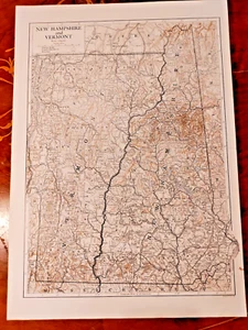
c1910 Emery Walker Map Print New Hampshire & Vermont United States Duotone USA

GBP 8.06
ApproximatelyUS $10.67
or Best Offer
Condition:
- Buy It Nowc1910 Emery Walker Map Print New Hampshire & Vermont United States Duotone USA
Oops! Looks like we're having trouble connecting to our server.
Refresh your browser window to try again.
Returns:
30 days returns. Buyer pays for return shipping. If you use an eBay shipping label, it will be deducted from your refund amount.
Payments:
Earn up to 5x points when you use your eBay Mastercard®. Learn moreabout earning points with eBay Mastercard
Shop with confidence
About this item
Seller assumes all responsibility for this listing.
eBay item number:116100455355
Item specifics
- Date Range
- 1900-1909
- Antique
- Yes
- Type
- Political Map
- Format
- Sheet Map
- US State
- New Hampshire
- Year
- 1910
- Era
- 1900s
- Cartographer/Publisher
- Thomas Kelly
- Original/Reproduction
- Vintage Original
- City
- Concord
- Country/Region
- United States of America
Item description from the seller

Seller feedback (5,430)
- y***n (4550)- Feedback left by buyer.Past monthVerified purchasearrived in 8 days, sturdily packed, good service.
- s***b (102)- Feedback left by buyer.Past 6 monthsVerified purchaseThe map was protectively packaged and arrived sooner than expected - I was very impressed by the standard of service offered by this ebayer!Original 1813 James Wallis County Map Bedfordshire Hand Colour Small Book Print (#116101015481)
- l***n (1019)- Feedback left by buyer.Past yearVerified purchaseItem exactly as stated, fast delivery, recommended vendor.Original 1920 OS Sheet Map Shepperton River Thames Littleton Upper Halliford Grn (#116055545028)
More to explore :
- United States of America New Hampshire Antique North America Folding Maps,
- United States of America New Hampshire Antique North America County Maps,
- United States of America New Hampshire Antique North America Atlas Maps,
- United States of America New Hampshire Antique North America Topographical Maps,
- United States of America New Hampshire Antique North America Maps & Atlases,
- Antique North American Maps & Atlases New Hampshire,
- New Hampshire Antique North America County Maps,
- New York New Hampshire Antique North America Maps & Atlases,
- Lithography New Hampshire Antique North America Atlas Maps,
- Rand McNally & Co. United States of America Vermont Antique North America Maps & Atlases
Seller feedback (5,430)
- y***n (4550)- Feedback left by buyer.Past monthVerified purchasearrived in 8 days, sturdily packed, good service.
- s***b (102)- Feedback left by buyer.Past 6 monthsVerified purchaseThe map was protectively packaged and arrived sooner than expected - I was very impressed by the standard of service offered by this ebayer!Original 1813 James Wallis County Map Bedfordshire Hand Colour Small Book Print (#116101015481)
- l***n (1019)- Feedback left by buyer.Past yearVerified purchaseItem exactly as stated, fast delivery, recommended vendor.Original 1920 OS Sheet Map Shepperton River Thames Littleton Upper Halliford Grn (#116055545028)