Sponsored
Sponsored
Skip to main content
Hi
!
Hi!
Sign in
or
register
Daily Deals
Brand Outlet
Gift Cards
Help & Contact
Sell
Watchlist
Expand Watch List
My eBay
Expand My eBay
Summary
Recently Viewed
Bids/Offers
Watchlist
Purchase History
Buy Again
Selling
Saved Feed
Saved Searches
Saved Sellers
Payments
My Garage
Preferences
My Collection
Messages
PSA Vault
Expand Notifications
Please
sign-in
to view notifications.
Expand Cart
Loading...
eBay Home
Shop by category
All Categories
Search
Advanced
Sponsored
Sponsored
breadcrumb
eBay
Collectibles & Art
Antiques
Maps, Atlases & Globes
Collectibles & Art
Antiques
Maps, Atlases & Globes
North America Maps
Woodcut CT, MA, ME, NH, RI, VT 1800-1899 Date Range Antique North America Maps & Atlases
Woodcut Antique North America Maps & Atlases CT, MA, ME, NH, RI, VT 1800-1899
Shop by category
Maps, Atlases & Globes
North America Maps
Africa Maps
Asia Maps
Australia/Oceania Maps
Celestial Maps
Central America/Caribbean Maps
Curiosities Maps
Digital Maps
Europe Maps
Map & Globe Mixed Lots
Map & Globe Reproductions
South America Maps
World & Celestial Globes
World Maps
All Listings
Auction
Buy It Now
Best Offer
Sort: Best Match
Best Match
Time: ending soonest
Time: newly listed
Price + Shipping: lowest first
Price + Shipping: highest first
Distance: nearest first
List View
Gallery View
2 results
Sort: Best Match
Best Match
Time: ending soonest
Time: newly listed
Price + Shipping: lowest first
Price + Shipping: highest first
Distance: nearest first
3 filters applied
Date Range: 1800-1899
- Selected
US State: CT, MA, ME, NH, RI, VT
- Selected
Printing Technique: Woodcut
- Selected
Date Range
(1)
1800-1899
(2)
US State
(1)
CT, MA, ME, NH, RI, VT
(2)
New York
(44)
DC, DE, MD, NJ, NY, PA
(41)
Pennsylvania
(13)
Louisiana
(5)
Maine
(4)
Mississippi
(4)
AL, FL, GA, MS, NC, SC
(4)
Illinois
(4)
Massachusetts
(4)
North Carolina
(3)
Ohio
(3)
AR, IA, KS, LA, MO, NE
(3)
Virginia
(2)
New Jersey
(2)
Georgia
(2)
Florida
(2)
Oklahoma
(2)
South Carolina
(2)
Tennessee
(2)
Printing Technique
(1)
Woodcut
(2)
Copper Plate
(55)
Lithography
(39)
Original/Reproduction
Antique Original
(2)
Format
Atlas
(2)
Condition
Not Specified
(2)
Price
$187.50 to $287.50
Delivery Options
Free Shipping
Free Local Pickup
Filter
All Filters
Shop on eBay
$479.99
Free shipping
Shop on eBay
$479.99
Free shipping
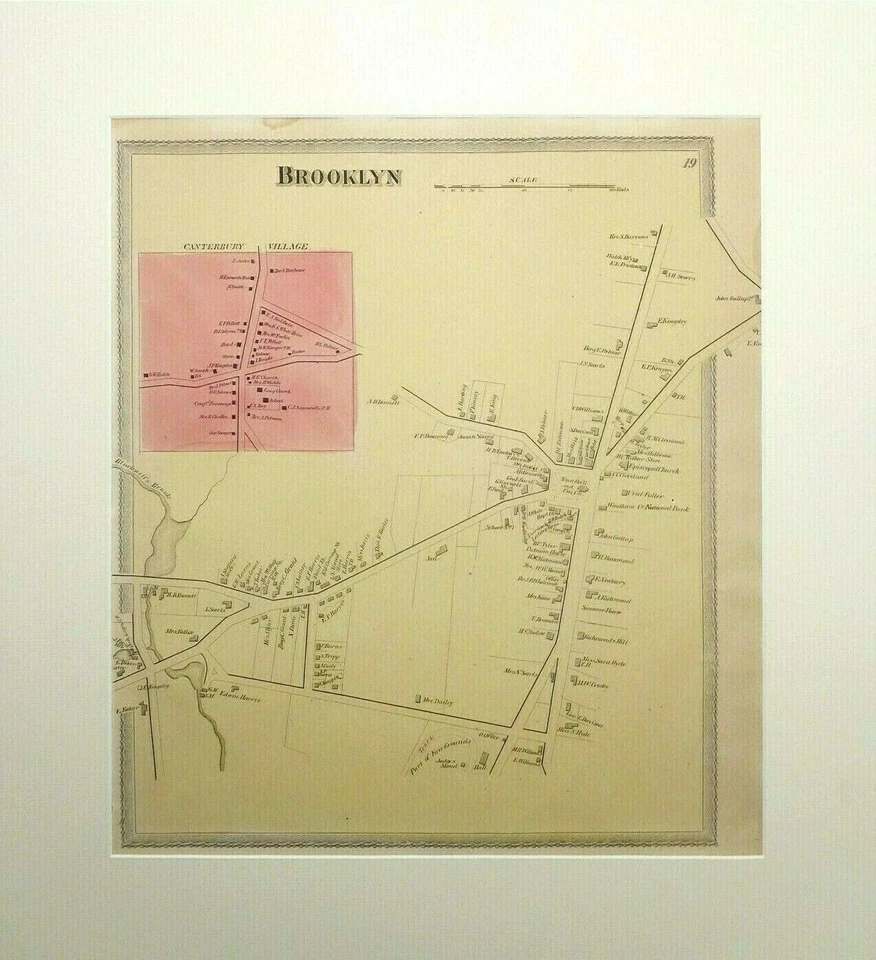
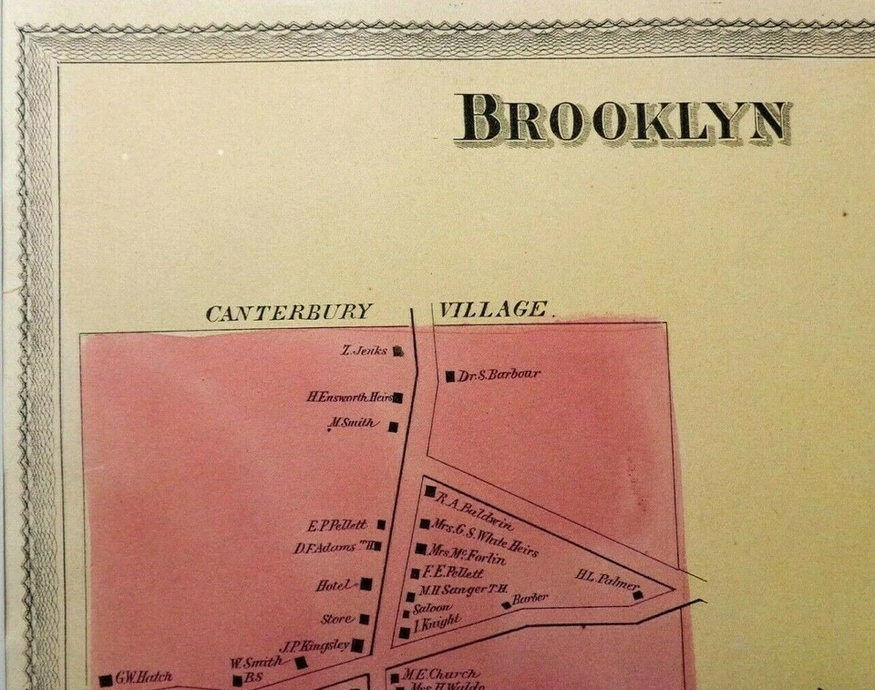
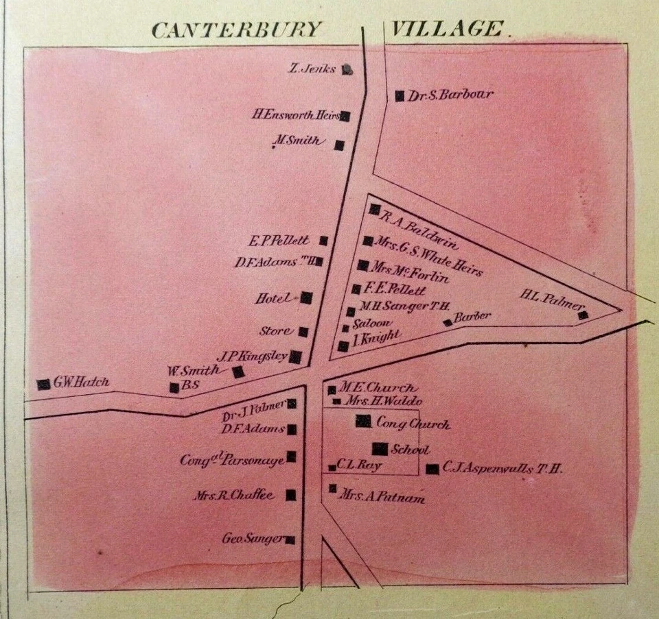
ANTIQUE 1869 BROOKLYN TOWN, CANTERBURY VILLAGE, CT HAND COLORED MAP, O. W. GRAY
$187.50
or Best Offer
$50.00 shipping
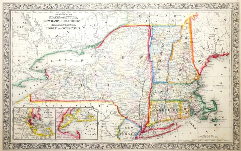
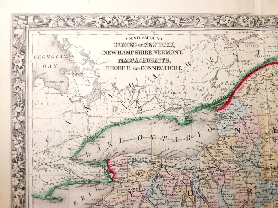
MID-19TH C ANTIQUE 1860 HAND COLORED NEW ENGLAND MAP BY S. AUGUSTUS MITCHELL JR.
$287.50
or Best Offer
$65.45 shipping
Related searches
Antique Maps North America
Antique Map United States
Antique Map of America
Antique State Maps
Antique Us Maps
Antique Map Prints
Antique Maps Framed
Antique Railroad Maps
Antique Montana Map
Antique Maps Book
1880 Map
Historical Atlases