Picture 1 of 7


Gallery
Picture 1 of 7


Have one to sell?
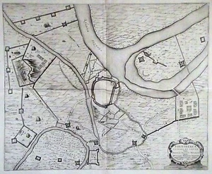
1601 Map of the Siege of Rheinberg, Rhenoberca, by Willem Janszoon Blaeu
US $100.00
as low as $34.11/mo with
Condition:
- Buy It Now1601 Map of the Siege of Rheinberg, Rhenoberca, by Willem Janszoon Blaeu
Oops! Looks like we're having trouble connecting to our server.
Refresh your browser window to try again.
Returns:
Seller does not accept returns.
Payments:
.
Special financing available. See terms and apply now- for PayPal Credit, opens in a new window or tab
Earn up to 5x points when you use your eBay Mastercard®. Learn moreabout earning points with eBay Mastercard
Shop with confidence
About this item
Seller assumes all responsibility for this listing.
eBay item number:256866761691
Item specifics
- Date Range
- 1600-1699
- Printing Technique
- Copper Plate
- Format
- Folding Map
- Year
- 1601
- Cartographer/Publisher
- Willem Blaeu
- Original/Reproduction
- Antique Original
- City
- Rheinberg
- Country/Region
- Present day Germany
Item description from the seller
Seller feedback (237)
- e***s (733)- Feedback left by buyer.Past monthVerified purchaseGREAT experience with this seller! As described with quick shipping!! Would do business again!!!
- n***d (121)- Feedback left by buyer.Past yearVerified purchaseQuick delivery, great packaging, as described, excellent value and well-preserved piece of history. Couldn't be happier. Thank you so much.1780 Colombia & Venezuela: Grenade, Andalousie, Guyane - Raynal / Bonne (#256866761692)
- i***u (2390)- Feedback left by buyer.Past monthVerified purchaseSehr schnelle Zusendung. Schöne Ware. Vielen Dank!
More to explore :
- Willem Blaeu Antique County Maps,
- Willem Blaeu Antique Folding Maps,
- Antique European Maps & Atlases Willem Blaeu,
- Willem Blaeu Antique World Maps & Atlases,
- Willem Blaeu Antique Maps, Atlases & Globes,
- Willem Blaeu County Map Antique World Folding Maps,
- Willem Blaeu Copper Plate Antique World Maps & Atlases,
- Willem Blaeu Copper Plate Antique Maps, Atlases & Globes,
- Willem Blaeu Copper Plate Antique Original Antique World Maps & Atlases,
- Willem Blaeu 1600-1699 Date Range Antique World County Maps