
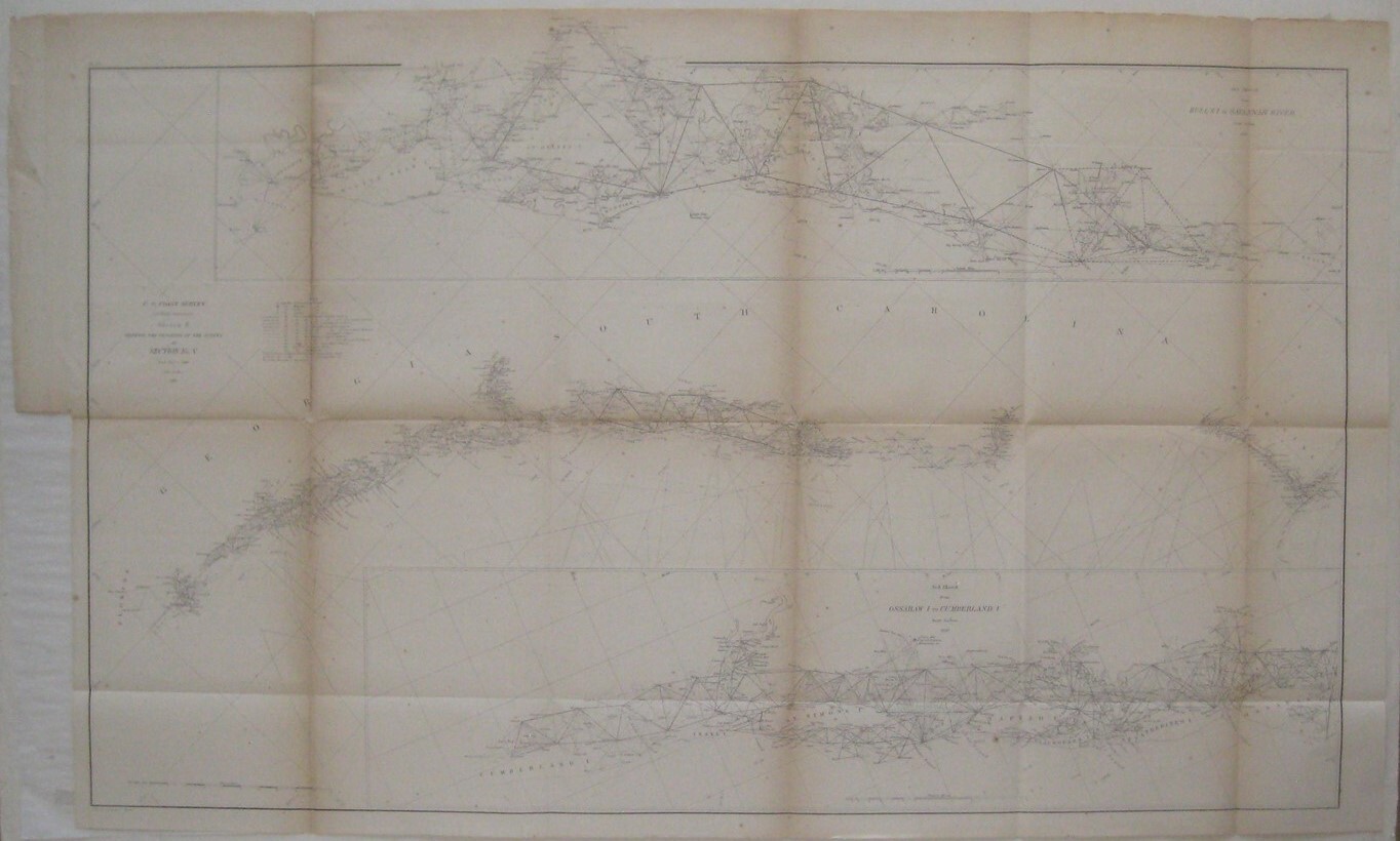
1860 US Coast Survey Map GEORGIA CAROLINAS Charleston Jekyll Island Hilton Head
US $59.99US $59.99
Sun, Oct 12, 08:54 AMSun, Oct 12, 08:54 AM
Picture 1 of 14


Gallery
Picture 1 of 14


Have one to sell?
1860 US Coast Survey Map GEORGIA CAROLINAS Charleston Jekyll Island Hilton Head

US $59.99
Condition:
“SEE BELOW FOR FULL DESCRIPTION. Printed on a lightweight paper which has toned and cracked along one ”... Read moreabout condition
Oops! Looks like we're having trouble connecting to our server.
Refresh your browser window to try again.
Shipping:
US $5.59 USPS First Class®.
Located in: Greenacres, Florida, United States
Delivery:
Estimated between Fri, Nov 7 and Fri, Nov 14 to 94104
Returns:
30 days returns. Seller pays for return shipping.
Payments:
.
Special financing available. See terms and apply now- for PayPal Credit, opens in a new window or tab
Earn up to 5x points when you use your eBay Mastercard®. Learn moreabout earning points with eBay Mastercard
Shop with confidence
Seller assumes all responsibility for this listing.
eBay item number:226537052160
Item specifics
- Seller Notes
- US State
- Georgia, North Carolina, South Carolina
- Type
- Topographical Map
- Format
- Folding Map
- Date Range
- 1800-1899
- Original/Reproduction
- Antique Original
- Country/Region
- United States of America
- Printing Technique
- Lithography
- Cartographer/Publisher
- U.S. Coast Survey
- Year
- 1860
- Product_Type
- Antique Map
- US_by_Areas
- Southeast Coast
Item description from the seller

Seller feedback (27,297)
This item (1)
All items (27,297)
- eBay automated feedback- Feedback left by buyer.Past monthOrder delivered on time with no issues
- a***a (432)- Feedback left by buyer.Past 6 monthsVerified purchaseExcellent seller! Shipped the same day as I ordered. However, USPS apparently misplaced the package. Let me change excellent seller to exceptional seller because Charlie responded immediately to my inquiry when it was apparent something was wrong, he kept me updated on the progress, and as soon as USPS allowed him to file a missing mail claim he did. And that got the map moving in the system and finally in my hands. Safe, secure packaging, too. I highly recommend New World Maps! Thank you!1983 FLORIDA Official Space Shuttle Columbia Road Map Orlando Jacksonville Tampa (#276880954612)
- 8***b (767)- Feedback left by buyer.Past yearVerified purchaseThis vintage brochure was accurately described. It's like brand new with no damage whatsoever--excellent condition. The price for the brochure and shipping cost was fine. Packaging was excellent. The brochure was sent in a hard stock cardboard envelope, the brochure in a plastic sleeve inside. Shipping was fast. Very happy with this transaction and seller. I would love to find another item to purchase as good as this one.1969 Schedule HEIDI FESTIVAL New Glarus Wisconsin Little Switzerland Craft Fair (#274561160175)
- o***t (242)- Feedback left by buyer.Past 6 monthsVerified purchasePackaged adequately for shipment, arrived just a but early, item was in very good condition considering age. Shipping cost was very reasonable. Finding publishing dates on maps can be tricky, but this was a 1947 map as advertised. Good transaction, satisfied customer.
More to explore :
- North Carolina Charleston Antique North America Maps & Atlases,
- South Carolina Charleston Antique North America Maps & Atlases,
- South Carolina Charleston Antique North America Atlas Maps,
- Antique Ordnance Survey Maps,
- Charleston Lithography South Carolina Antique North American Maps & Atlases,
- Antique Europe Ordnance Survey Maps,
- North Carolina Charleston Antique Original Antique North America Maps & Atlases,
- Antique Original Antique Ordnance Survey Maps,
- Antique North American Maps & Atlases Charleston,
- Antique North American Maps & Atlases Georgia
Seller feedback (27,297)
This item (1)
All items (27,297)
- eBay automated feedback- Feedback left by buyer.Past monthOrder delivered on time with no issues
- a***a (432)- Feedback left by buyer.Past 6 monthsVerified purchaseExcellent seller! Shipped the same day as I ordered. However, USPS apparently misplaced the package. Let me change excellent seller to exceptional seller because Charlie responded immediately to my inquiry when it was apparent something was wrong, he kept me updated on the progress, and as soon as USPS allowed him to file a missing mail claim he did. And that got the map moving in the system and finally in my hands. Safe, secure packaging, too. I highly recommend New World Maps! Thank you!1983 FLORIDA Official Space Shuttle Columbia Road Map Orlando Jacksonville Tampa (#276880954612)
- 8***b (767)- Feedback left by buyer.Past yearVerified purchaseThis vintage brochure was accurately described. It's like brand new with no damage whatsoever--excellent condition. The price for the brochure and shipping cost was fine. Packaging was excellent. The brochure was sent in a hard stock cardboard envelope, the brochure in a plastic sleeve inside. Shipping was fast. Very happy with this transaction and seller. I would love to find another item to purchase as good as this one.1969 Schedule HEIDI FESTIVAL New Glarus Wisconsin Little Switzerland Craft Fair (#274561160175)
- o***t (242)- Feedback left by buyer.Past 6 monthsVerified purchasePackaged adequately for shipment, arrived just a but early, item was in very good condition considering age. Shipping cost was very reasonable. Finding publishing dates on maps can be tricky, but this was a 1947 map as advertised. Good transaction, satisfied customer.